Chauffeur Tours of Ireland
Luxury Irish Experiences
Sit back and let our expert Irish driver-guides show you the magic of the Emerald Isle. Enjoy premium vehicles, local insights, and VIP access to attractions.
Ireland Chauffeur Packages
Your Irish Chauffeur Experience Includes
Expert Driver-Guide
Local Irish storytellers
Luxury Vehicle
Mercedes V-Class or similar
VIP Access
Skip lines at attractions
Authentic Ireland
Hidden gems & local pubs
Best Chauffeur Tours in Ireland
 Featured
Dublin
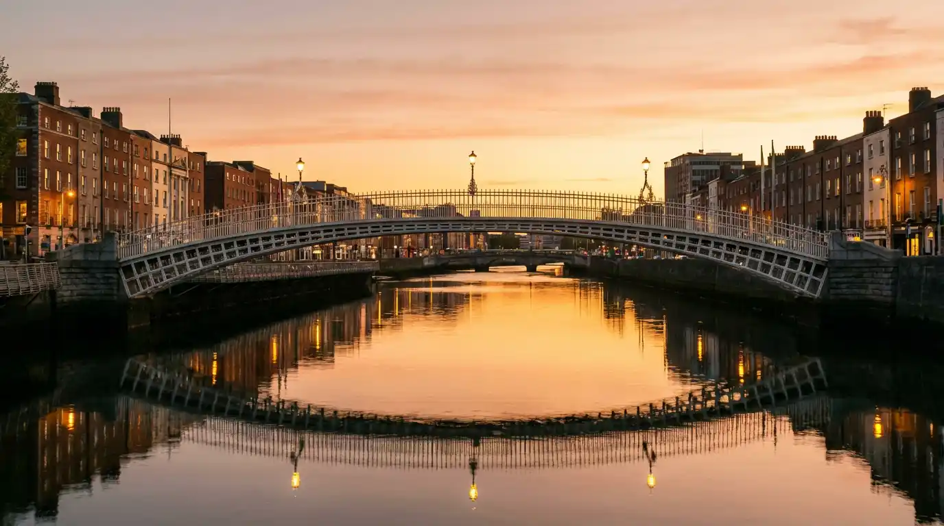
Dublin is Ireland's capital and largest city, home to over 1.4 million people in its greater metropolitan area. Situated on the east coast at the mouth of the River Liffey, the city has been a centre of commerce, culture, and political power since the Vikings established a settlement here in the 9th century. The city divides naturally along the Liffey into the Northside and Southside. South of the river, Trinity College — founded in 1592 — anchors the university quarter, while the Georgian terraces of Merrion Square and Fitzwilliam Square form one of the finest collections of 18th-century architecture in Europe. Grafton Street connects Trinity to St Stephen's Green, one of the city's largest public parks. North of the Liffey, O'Connell Street runs past the General Post Office, a key site in the 1916 Easter Rising, toward the rejuvenated Smithfield and Stoneybatter neighbourhoods. Dublin's literary heritage is unmatched for a city of its size. James Joyce, Oscar Wilde, Samuel Beckett, and W.B. Yeats all called the city home, and their presence is woven into the streetscape — from the Oscar Wilde statue in Merrion Square to the James Joyce Tower in Sandycove. The city hosts Bloomsday on June 16th each year, retracing the steps of Leopold Bloom through the Dublin that Joyce immortalised in Ulysses. Beyond the centre, Dublin's coastline stretches from the fishing village of Howth in the north to the Victorian pier towns of Dún Laoghaire and Dalkey in the south. The Wicklow Mountains rise just 50 kilometres to the south, offering an easy escape into rugged upland scenery. To the north, the Boyne Valley holds some of Ireland's most important archaeological sites, including the passage tomb at Newgrange.
 Featured
Galway
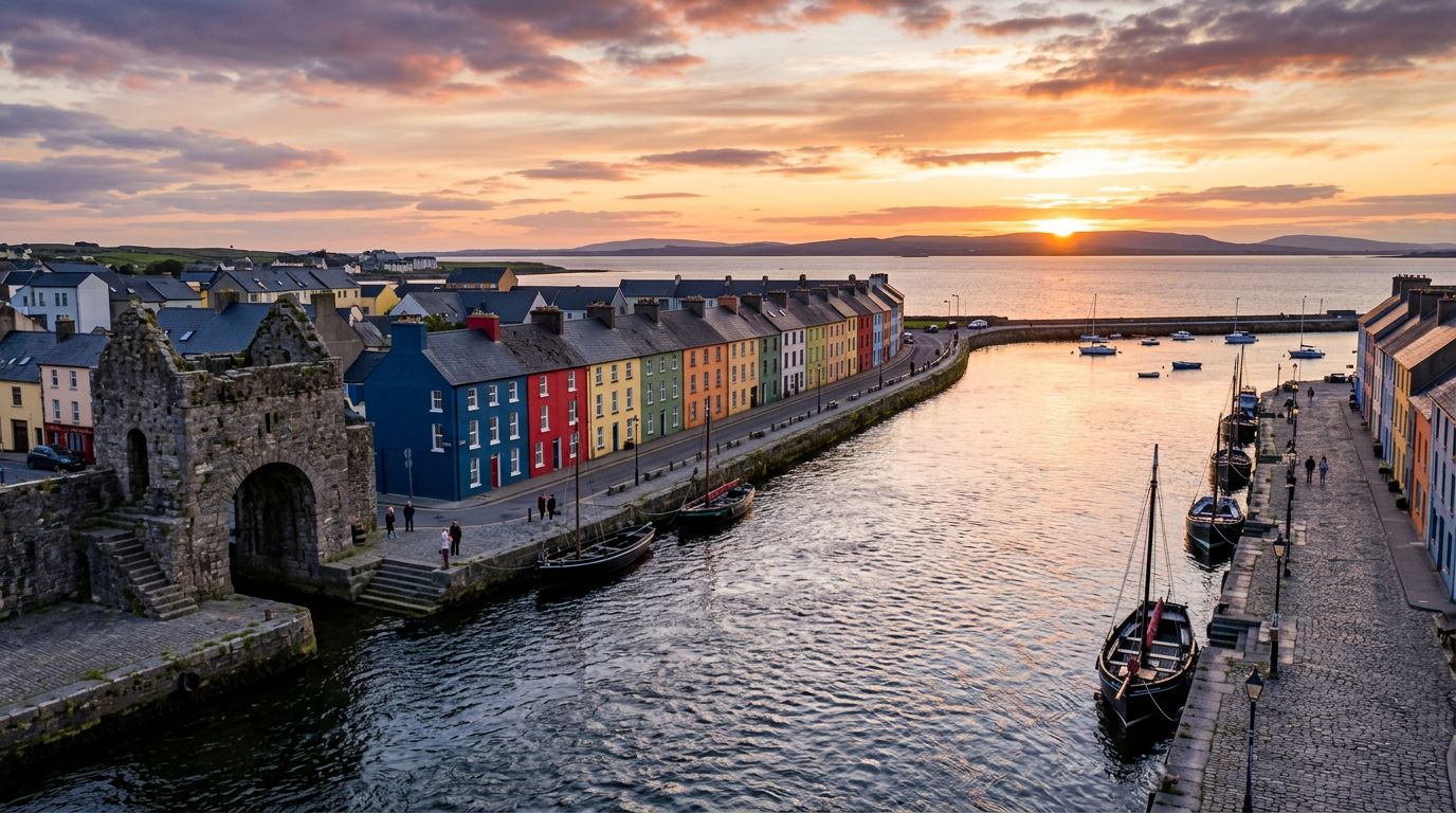
Galway sits on Ireland's Atlantic coast, a compact city that punches well above its weight for culture, food, and live music. The Latin Quarter — centred on Shop Street and Quay Street — is a pedestrian-friendly tangle of painted shopfronts, buskers, and restaurant terraces that stays lively well into the evening. The Spanish Arch, one of the last remnants of the medieval city walls, overlooks the mouth of the River Corrib where it meets Galway Bay. Across the bridge, the Claddagh — once an independent fishing village — gave its name to the famous ring design that originated here. The city is the gateway to Connemara, a wild stretch of bog, lake, and mountain that begins less than an hour's drive west. Clifden, Connemara's unofficial capital, anchors the Sky Road — a 16-kilometre coastal loop with views across island-studded Clifden Bay. Connemara National Park at Letterfrack offers the Diamond Hill walk, a well-maintained trail that climbs to panoramic views of the Twelve Bens mountain range. Kylemore Abbey, a 19th-century Benedictine monastery on the shore of a lake, is one of the most photographed buildings in the west of Ireland. Off the coast, the Aran Islands — Inis Mór, Inis Meáin, and Inis Oírr — preserve a way of life that has all but disappeared on the mainland. Ferries from Rossaveal, a 45-minute drive from the city, reach Inis Mór in about 40 minutes. There, the Bronze Age fort of Dún Aonghasa sits on the edge of a 100-metre cliff, and the island is best explored by bicycle. Galway has earned its reputation as Ireland's festival capital. The Galway International Arts Festival fills two weeks in July with theatre, visual art, and street performance. The Galway Races follow immediately after — a week-long horse racing festival that doubles as the city's biggest social event. In September, the International Oyster and Seafood Festival, the world's longest-running oyster festival, rounds out the summer season.
 Featured
Kerry
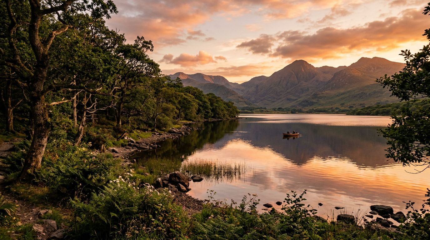
County Kerry occupies the southwest corner of Ireland, where the highest mountains on the island meet one of its most rugged Atlantic coastlines. The McGillycuddy's Reeks — home to Carrauntoohil, Ireland's tallest peak at 1,038 metres — rise above Killarney National Park, a 10,000-hectare expanse of oak woodland, peat bog, and three interconnected lakes. The park holds Muckross House, a Victorian mansion set among landscaped gardens, and Ross Castle, a 15th-century tower on the shore of Lough Leane. The Iveragh Peninsula forms Kerry's western arm, circled by the 179-kilometre Ring of Kerry driving route. The road threads through a string of small towns — Kenmare, Sneem, Waterville, Cahersiveen, Killorglin — and passes viewpoints like Ladies View and Moll's Gap that look back across the lakes and mountains. Off the southern coast, Skellig Michael rises from the Atlantic: a UNESCO World Heritage Site where early Christian monks built a monastery on a rock pinnacle 217 metres above the sea. Beyond the headline attractions, Kerry rewards slower exploration. The town of Killarney serves as the main gateway, with a dense core of restaurants, traditional pubs, and accommodation ranging from guesthouses to lakeside hotels. Kenmare, at the head of Kenmare Bay, is quieter and known for its food scene and craft shops. The Kerry Cliffs near Portmagee stand 300 metres above the ocean and offer views of the Skellig Islands on clear days. Tralee, the county capital, hosts the Rose of Tralee festival each August, while Killorglin's Puck Fair — one of Ireland's oldest — crowns a wild goat king over three days of markets and music.
 Featured
Cork
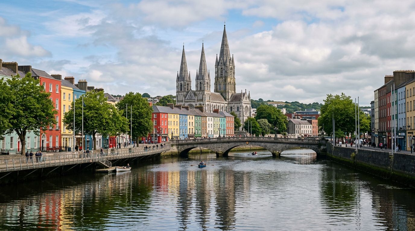
Cork is Ireland's second city and its unofficial food capital. The city centre sits on an island in the River Lee, with the English Market — a covered food hall trading since 1788 — at its heart. Inside, stalls sell local specialities from artisan cheeses and fresh Atlantic fish to spiced beef and buttered eggs. Above the trading floor, the Farmgate Café serves the market's own ingredients with a view of the bustle below. North of the centre, the steep streets of Shandon climb to St. Anne's Church, where visitors can ring the famous Shandon Bells. To the south, St. Fin Barre's Cathedral anchors the university quarter, and University College Cork's campus spreads along the Western Road. Cork is a city of narrow lanes, independent shops, and a food and drink scene that rivals Dublin's at a fraction of the pace. The surroundings match the city for variety. Blarney Castle, 8 kilometres northwest, is a 15th-century tower house built by the MacCarthy clan in 1446. Visitors lean back over the battlements 27 metres up to kiss the Blarney Stone for the legendary "gift of eloquence." Cobh, the colourful harbour town 25 minutes east by commuter rail, was the last port of call for the RMS Titanic on 11 April 1912 — the Titanic Experience museum occupies the original White Star Line ticket office. Kinsale, 30 kilometres south, is known as the gourmet capital of Ireland, with a harbour-front strip of restaurants, Charles Fort, and the Old Head headland. Further afield, West Cork opens up along the coast toward the Beara and Mizen Head peninsulas, marking the start of the Wild Atlantic Way. The Jameson Distillery at Midleton, 25 kilometres east, offers tours through the original whiskey-making buildings.
 Featured
Clare
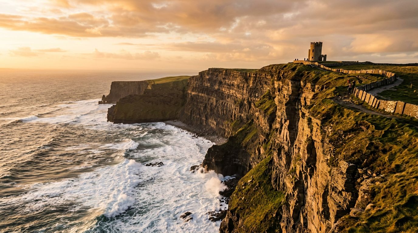
County Clare occupies the Atlantic coast between Galway Bay and the Shannon Estuary, a compact county that packs three of Ireland's most distinctive landscapes into a single day's driving. The Cliffs of Moher rise 214 metres above the Atlantic on the western coast, stretching 8 kilometres from Liscannor in the south to Doolin in the north. They are Ireland's most visited natural attraction and one of the most recognisable landmarks along the Wild Atlantic Way. Inland, the Burren is a 250-square-kilometre expanse of limestone karst that looks like no other landscape in Ireland — or anywhere else. The bare grey rock, cracked into a grid of fissures called grikes, supports a remarkable botanical mix: Mediterranean, Arctic, and Alpine plants grow side by side in the sheltered crevices, a combination found nowhere else in the world. The Poulnabrone Dolmen, a 5,800-year-old portal tomb standing in the middle of the limestone pavement, is the Burren's most photographed monument. Doolin sits between the Cliffs and the Burren, a village that has become synonymous with traditional Irish music. Gus O'Connor's Pub, McGann's, and MacDiarmada's host music sessions most evenings, drawing musicians from across the country. Doolin is also the departure point for ferries to the Aran Islands — Inis Oírr, the smallest island, is a 20-minute crossing. Beyond the headline trio, Clare offers the Loop Head Peninsula — a 64-kilometre drive from Kilkee to the lighthouse at Loop Head, where dolphins are frequently spotted from the cliffs. Bunratty Castle and Folk Park, near Shannon Airport, is a well-preserved 15th-century tower house with a reconstructed 19th-century village. The county town of Ennis has a compact centre with its own traditional music scene, centred on Brogan's Bar and Ciaran's Bar.
 Featured
Donegal
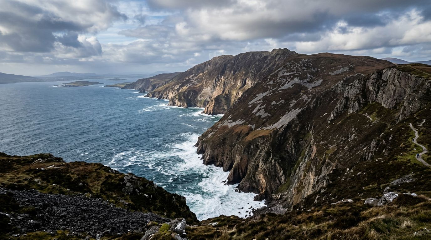
County Donegal occupies Ireland's remote northwest corner, a sprawling county of mountain, bog, and Atlantic coastline that feels more distant from Dublin than its 270 kilometres suggest. It holds some of the most dramatic landscapes in the country — and some of the least visited, because its position beyond the reach of the main motorway network keeps the crowds at bay. Slieve League, on the southwest coast near the fishing port of Killybegs, is the county's most dramatic single feature. The sea cliffs rise to 601 metres — nearly three times the height of the Cliffs of Moher — making them among the highest accessible sea cliffs in Europe. You can drive to the Bunglas viewing point or walk the One Man's Pass ridge for vertiginous views of Donegal Bay and the Sligo Mountains beyond. Below, at the harbour of Teelin, a memorial marks the departure point of fifth-century monks who sailed to Iceland. The northern coast is a different world. Fanad Head Lighthouse, at the tip of the Fanad Peninsula, has been voted one of the most beautiful lighthouses in the world. The drive around the peninsula — a 75-kilometre loop via the Harry Blaney Bridge connecting Fanad to the Rosguill Peninsula — follows the edge of Lough Swilly past white-sand beaches and clear Atlantic water. Malin Head, on the Inishowen Peninsula, is the northernmost point of mainland Ireland and the start (or end) of the Wild Atlantic Way. The rocks here are among the oldest in Ireland, and the headland was used as a filming location for Star Wars: The Last Jedi. Between the coasts, Glenveagh National Park covers 16,000 hectares of mountain, bog, and lake in the centre of the county. The castle at its heart, a 19th-century building overlooking Lough Veagh, is surrounded by gardens that include species from around the world. The Inishowen 100 — a 160-kilometre signposted driving loop around the Inishowen Peninsula — takes in Malin Head, the Gap of Mamore, Five Finger Strand, and the walled town of Derry at its eastern end.
 Featured
Wild Atlantic Way
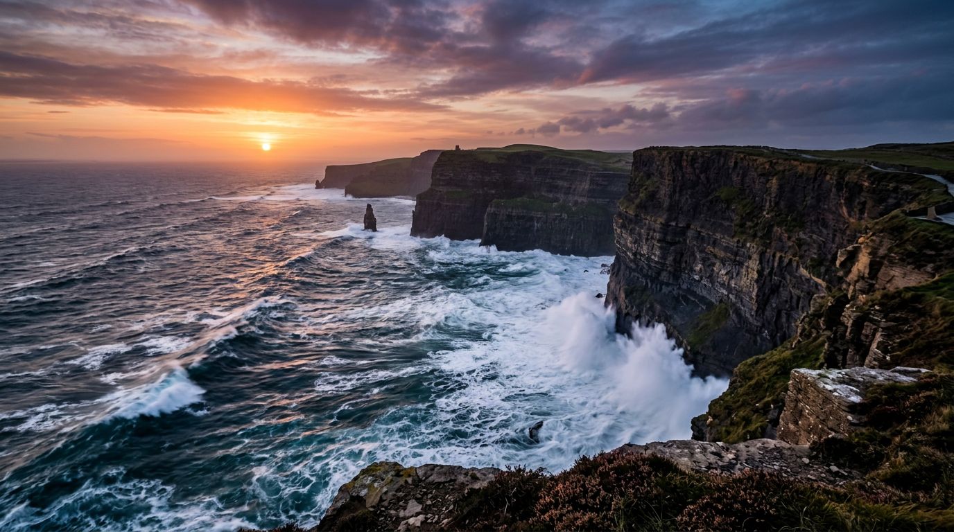
The Wild Atlantic Way is a 2,500-kilometre coastal driving route — the longest defined coastal touring route in the world — stretching from Malin Head in County Donegal to the Old Head of Kinsale in County Cork. It passes through nine counties and three provinces, hugging Ireland's Atlantic seaboard through some of the most dramatic coastal scenery in Europe. The route is marked by distinctive wave-shaped signposts and features over 150 official discovery points, each chosen for its coastal views, heritage, or wildlife. The highlights read like a greatest-hits of western Ireland: the Cliffs of Moher rising 214 metres above the Atlantic in Clare, the Skellig Islands off the Kerry coast, the wild bog of Connemara in Galway, the sea stacks and arches of Achill Island in Mayo, the 600-metre Slieve League cliffs in Donegal, and Malin Head — Ireland's most northerly point — where the Atlantic weather arrives first. The route divides naturally into five sections. The southwest (Kerry and Cork) takes in the Ring of Kerry, the Beara Peninsula, and Mizen Head. The midwest (Clare and Limerick) covers the Cliffs of Moher, the Burren, and Loop Head. The west (Galway and Mayo) passes through Connemara, the Aran Islands, and Achill Island. The northwest (Sligo, Leitrim, and Donegal) reaches Slieve League, Fanad Head Lighthouse, and the Inishowen Peninsula. Most travellers cover the full route in 10 to 14 days, though it can be tackled in shorter sections. The signposted discovery points make navigation straightforward, and the route mixes main roads with quieter coastal lanes that reward a slower pace.
 Featured
Ring of Kerry
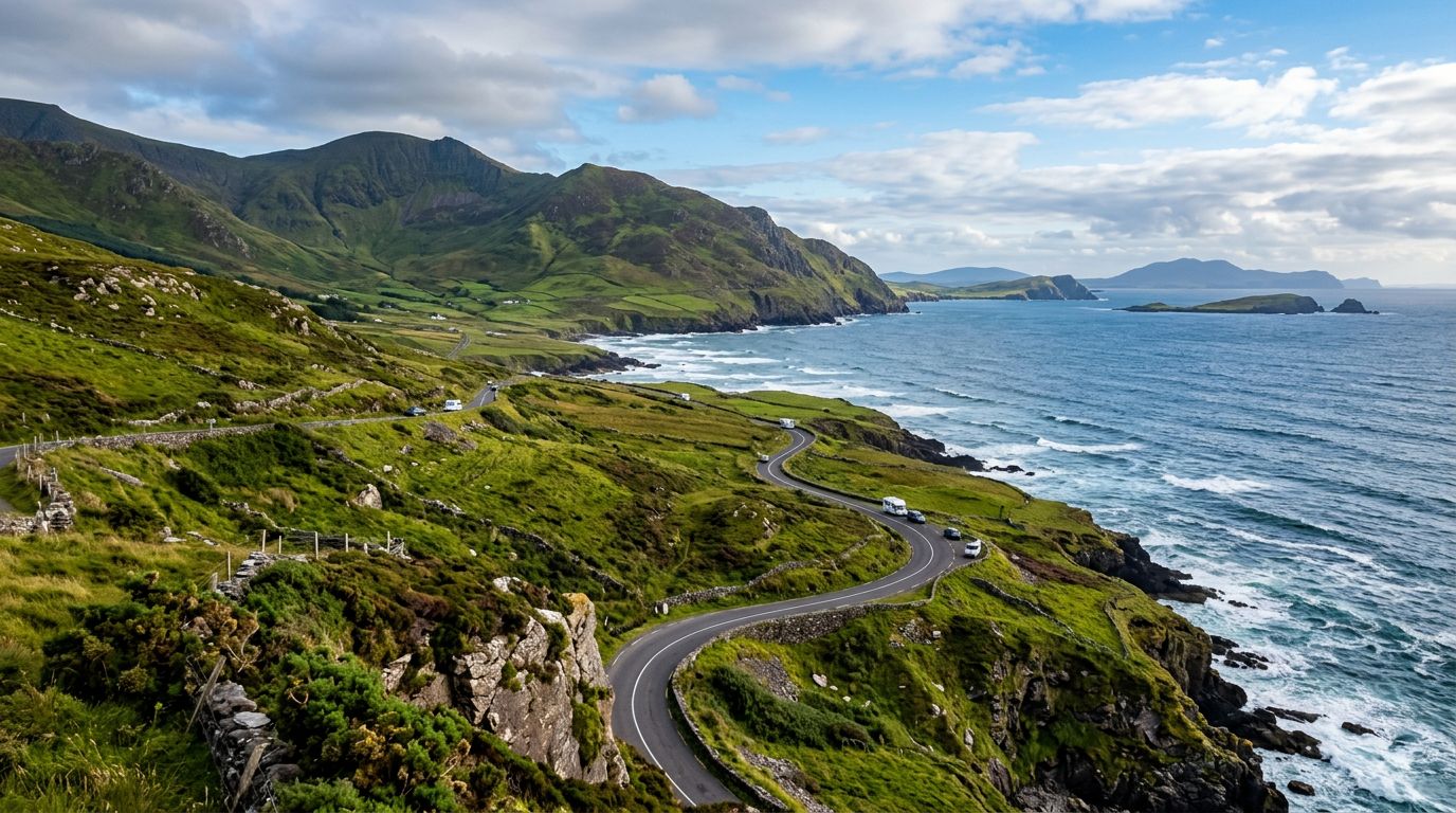
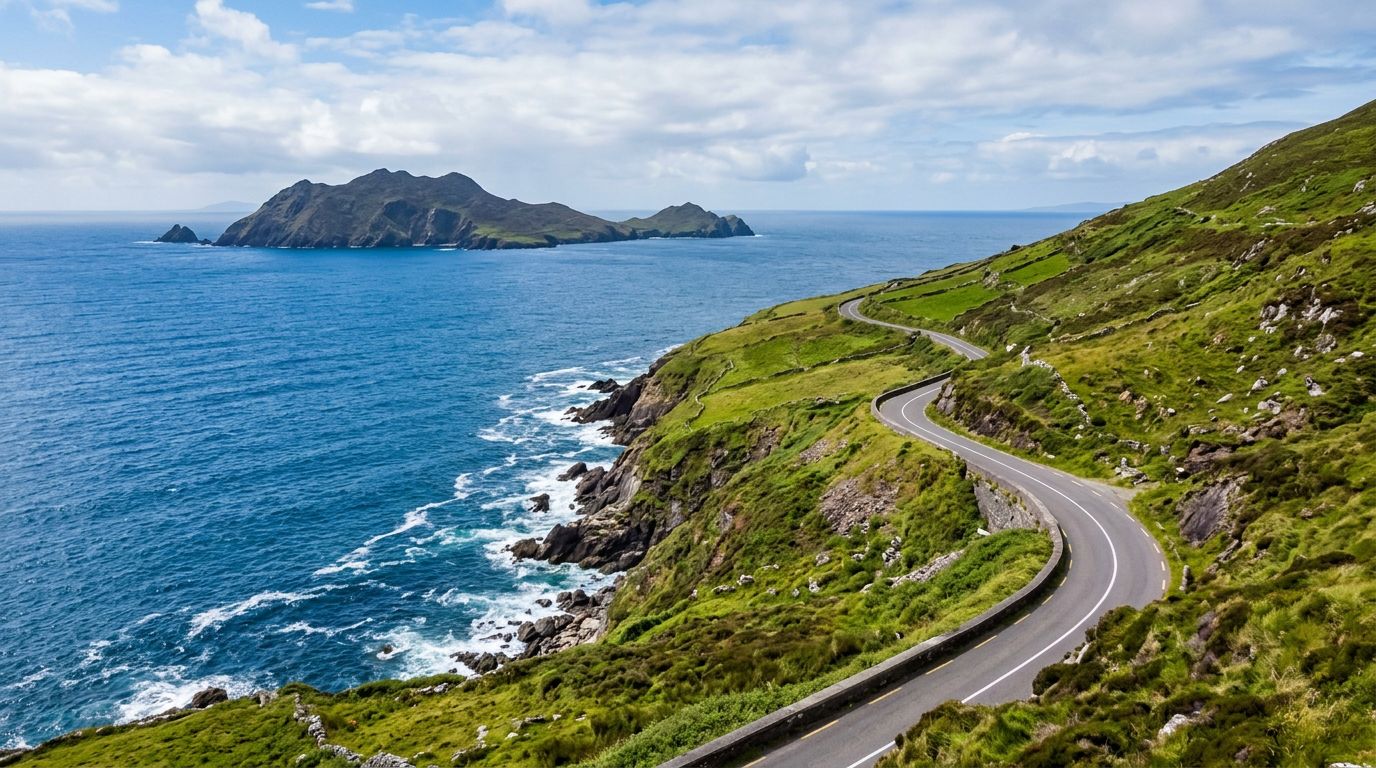
The Ring of Kerry is a 179-kilometre circular driving route around the Iveragh Peninsula in southwest Ireland, following the N71 and N70 roads through some of the most dramatic coastal and mountain scenery on the island. The route starts and ends in Killarney, threading through a string of towns and villages — Kenmare, Sneem, Caherdaniel, Waterville, Cahersiveen, Glenbeigh, and Killorglin — each with its own character and stopping points. Leaving Killarney, the road climbs through Killarney National Park past Torc Waterfall and the panoramic viewpoint at Ladies View before descending through Moll's Gap — the highest point on the route at 235 metres — into the colourful heritage town of Kenmare. From here the N70 hugs the coast westward through Sneem, a village of brightly painted houses on the Kenmare River estuary, and on to Caherdaniel, where Derrynane Beach and the Staigue Stone Fort reward a stop. The western reaches of the peninsula are the wildest. Waterville sits on a narrow strip between Ballinskelligs Bay and Lough Currane, and from here the Skellig Ring — an 18-kilometre detour off the main route — loops through Portmagee and past the Kerry Cliffs, where the rock drops 300 metres to the Atlantic and the Skellig Islands sit on the horizon. Off the coast, Skellig Michael rises 217 metres from the sea, a UNESCO World Heritage Site where sixth-century monks built a monastery on a rock pinnacle accessible only by boat between May and October. The northern arc of the Ring passes through Cahersiveen — the birthplace of Daniel O'Connell — and the seaside villages of Glenbeigh and Killorglin before returning to Killarney. The route can be driven without stopping in roughly 2.5 to 3 hours, but most visitors allow 7 to 10 hours with stops, and splitting it over two days opens up the detours that make the difference.
 Featured
Dingle Peninsula
The Dingle Peninsula is the northernmost of Kerry's three Atlantic peninsulas, reaching further west into the ocean than any other point on the Irish mainland. It is a Gaeltacht area — Irish is the first language in many of the villages along the western coast — and this cultural identity shapes the peninsula's character as much as its geography. Dingle town sits roughly halfway along the peninsula's southern coast, a compact harbour town with a reputation for seafood, traditional music, and a social atmosphere that belies its small size. The narrow streets are lined with brightly painted pubs and restaurants, and on any evening of the week you can find live music in at least half a dozen venues. The harbour is the town's working heart — fishing boats land catches that appear on restaurant menus the same evening. West of Dingle, the Slea Head Drive is a 38-kilometre clockwise loop along the R559 that traces the peninsula's most dramatic coastline. The road passes Ventry Beach, the Iron Age promontory fort at Dunbeg, the Fahan group of beehive huts, and rounds Slea Head itself — the most westerly point, with views of the Blasket Islands sitting in the Atlantic. Dunquin Pier, a zigzag path cut into the cliff face, is the departure point for boats to Great Blasket Island. Gallarus Oratory, near the drive's end, is a perfectly preserved early Christian stone church shaped like an upturned boat. North of Dingle town, the Conor Pass (R560) climbs to 456 metres — one of the highest mountain passes in Ireland — through a glacial landscape of corrie lakes, hanging valleys, and bare rock. The summit car park offers views south over Dingle Bay and north to Brandon Bay and the Maharees. The pass road is narrow, steep, and not suitable for large vehicles.
 Featured
Connemara
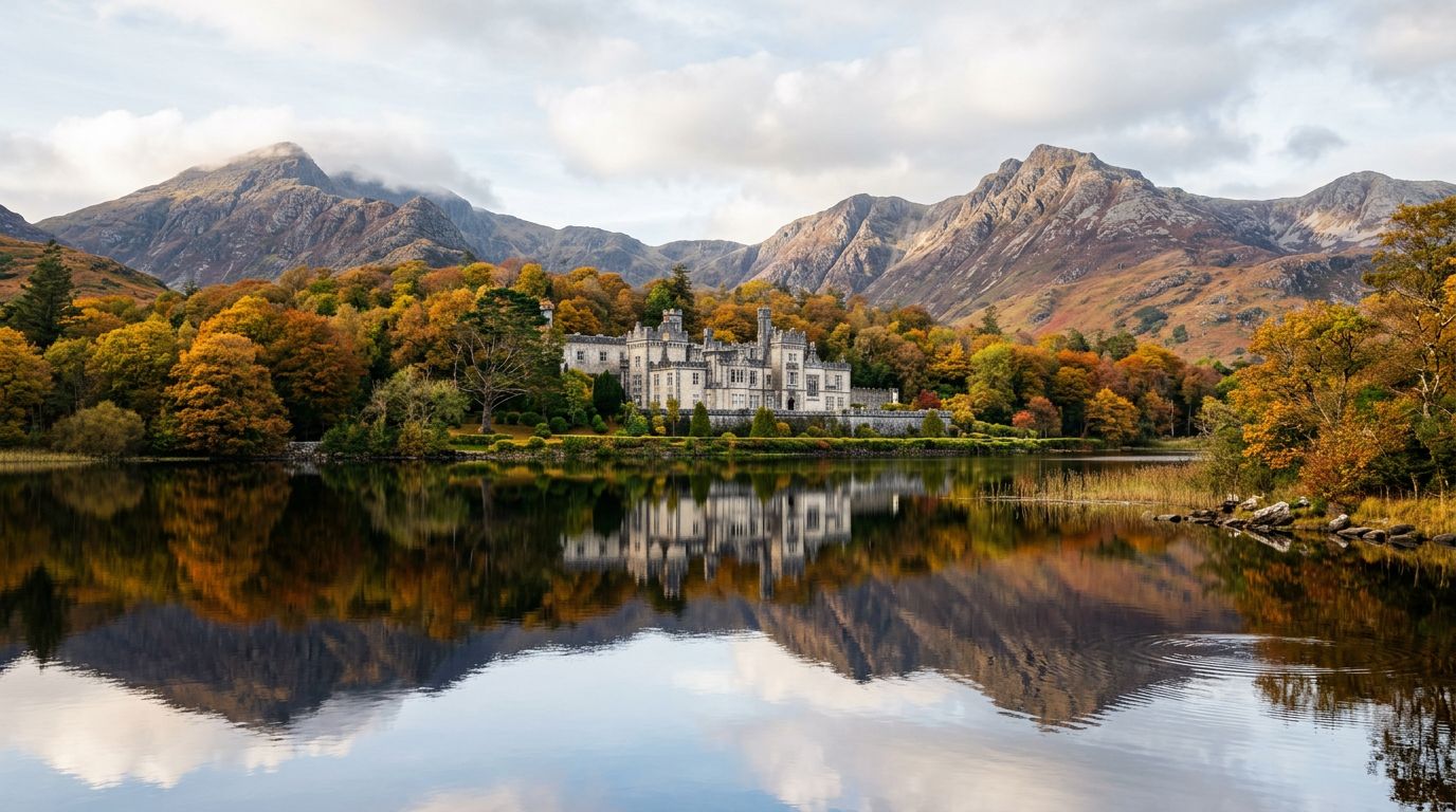
Connemara occupies the western third of County Galway, a triangle of land between Galway Bay to the south, the Atlantic to the west, and Killary Harbour — Ireland's only fjord — to the north. It is a landscape defined by extremes: the Twelve Bens mountain range reaches 729 metres at Benbaun, while the surrounding blanket bog stretches unbroken to the horizon in every direction. Between them, a network of lakes, rivers, and stone walls creates a patchwork that has changed little in centuries. The N59 from Galway runs through the heart of Connemara, passing through Oughterard — the traditional gateway — and on to Clifden, roughly 80 kilometres and 75 minutes west. Clifden is Connemara's unofficial capital, a small hillside town of colourful shopfronts overlooking Ardbear Bay. From here, the Sky Road is a 16-kilometre loop along the coast with views across island-studded Clifden Bay that justify the drive alone. South of Clifden, the coastal villages of Roundstone, Ballyconneely, and the twin beaches of Dog's Bay and Gurteen Bay add a completely different character — white sand against the bog. Kylemore Abbey sits on the shore of Pollacappul Lough, 20 kilometres east of Clifden on the N59. Built in the 1860s as a private residence, it became a Benedictine monastery in 1920 and today is one of the most visited attractions in the west of Ireland. The adjacent Connemara National Park at Letterfrack — just 5 kilometres from the Abbey — offers Diamond Hill, a 442-metre peak with a well-maintained trail that climbs to panoramic views of the Twelve Bens, the coastline, and the Abbey itself. The full walk takes 2 to 3 hours. Connemara remains one of the largest Gaeltacht (Irish-speaking) areas in the country. In villages like Spiddal, Carraroe, and Carna along the southern coast, Irish is the first language of daily life. This cultural layer adds a dimension that no other region in the west matches.
 Featured
Causeway Coastal Route
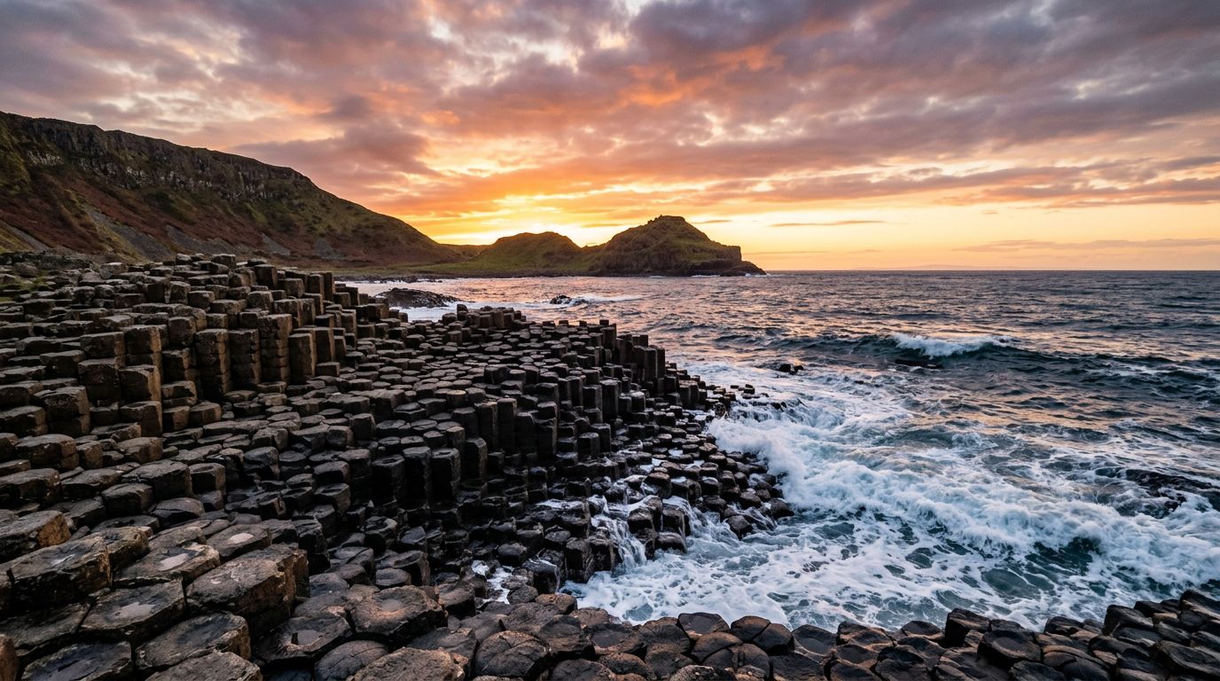
The Causeway Coastal Route is a 120-mile (190-kilometre) driving route along the north coast of Northern Ireland between Belfast and Derry/Londonderry. Consistently rated among the world's greatest coastal drives, it combines dramatic geology, ruined clifftop castles, the nine Glens of Antrim, and a UNESCO World Heritage Site into a single linear journey. The Giant's Causeway is the route's centrepiece — a formation of roughly 40,000 interlocking basalt columns, formed by an ancient volcanic eruption, stepping down from the cliff into the North Atlantic. It is Northern Ireland's only UNESCO World Heritage Site and one of the most visited natural attractions in Ireland. The visitor centre, managed by the National Trust, sits above the columns and offers audio-guided tours. The Carrick-a-Rede Rope Bridge, near Ballintoy, is a 20-metre rope bridge slung 30 metres above the sea, connecting the mainland to a small island once used by salmon fishermen. Nearby, Ballintoy Harbour — a photogenic cove with limestone rocks and a small stone quay — served as the Iron Islands harbour in Game of Thrones. The Dark Hedges, an avenue of gnarled beech trees planted in the 18th century, appeared as the Kingsroad in the same series and is one of the most photographed spots in Northern Ireland. Dunluce Castle, between Bushmills and Portrush, is a dramatic clifftop ruin perched on a basalt outcrop above the Atlantic. Parts of the castle kitchen fell into the sea during a storm in 1639. Bushmills Distillery, in the nearby village, holds the title of the world's oldest licensed whiskey distillery, with tours running year-round. The Glens of Antrim — nine glacier-carved valleys running from the mountains to the sea — fill the route's middle section between Belfast and Ballycastle. Glenariff, the widest glen, has a waterfall walk through a forested gorge. The coastal villages of Carnlough, Cushendall, and Cushendun are well-preserved and atmospheric stopping points.
All Ireland Chauffeur Destinations
FeaturedDublin
Dublin is Ireland's capital and largest city, home to over 1.4 million people in its greater metropolitan area. Situated on the east coast at the mouth of the River Liffey, the city has been a centre of commerce, culture, and political power since the Vikings established a settlement here in the 9th century. The city divides naturally along the Liffey into the Northside and Southside. South of the river, Trinity College — founded in 1592 — anchors the university quarter, while the Georgian terraces of Merrion Square and Fitzwilliam Square form one of the finest collections of 18th-century architecture in Europe. Grafton Street connects Trinity to St Stephen's Green, one of the city's largest public parks. North of the Liffey, O'Connell Street runs past the General Post Office, a key site in the 1916 Easter Rising, toward the rejuvenated Smithfield and Stoneybatter neighbourhoods. Dublin's literary heritage is unmatched for a city of its size. James Joyce, Oscar Wilde, Samuel Beckett, and W.B. Yeats all called the city home, and their presence is woven into the streetscape — from the Oscar Wilde statue in Merrion Square to the James Joyce Tower in Sandycove. The city hosts Bloomsday on June 16th each year, retracing the steps of Leopold Bloom through the Dublin that Joyce immortalised in Ulysses. Beyond the centre, Dublin's coastline stretches from the fishing village of Howth in the north to the Victorian pier towns of Dún Laoghaire and Dalkey in the south. The Wicklow Mountains rise just 50 kilometres to the south, offering an easy escape into rugged upland scenery. To the north, the Boyne Valley holds some of Ireland's most important archaeological sites, including the passage tomb at Newgrange.
FeaturedGalway
Galway sits on Ireland's Atlantic coast, a compact city that punches well above its weight for culture, food, and live music. The Latin Quarter — centred on Shop Street and Quay Street — is a pedestrian-friendly tangle of painted shopfronts, buskers, and restaurant terraces that stays lively well into the evening. The Spanish Arch, one of the last remnants of the medieval city walls, overlooks the mouth of the River Corrib where it meets Galway Bay. Across the bridge, the Claddagh — once an independent fishing village — gave its name to the famous ring design that originated here. The city is the gateway to Connemara, a wild stretch of bog, lake, and mountain that begins less than an hour's drive west. Clifden, Connemara's unofficial capital, anchors the Sky Road — a 16-kilometre coastal loop with views across island-studded Clifden Bay. Connemara National Park at Letterfrack offers the Diamond Hill walk, a well-maintained trail that climbs to panoramic views of the Twelve Bens mountain range. Kylemore Abbey, a 19th-century Benedictine monastery on the shore of a lake, is one of the most photographed buildings in the west of Ireland. Off the coast, the Aran Islands — Inis Mór, Inis Meáin, and Inis Oírr — preserve a way of life that has all but disappeared on the mainland. Ferries from Rossaveal, a 45-minute drive from the city, reach Inis Mór in about 40 minutes. There, the Bronze Age fort of Dún Aonghasa sits on the edge of a 100-metre cliff, and the island is best explored by bicycle. Galway has earned its reputation as Ireland's festival capital. The Galway International Arts Festival fills two weeks in July with theatre, visual art, and street performance. The Galway Races follow immediately after — a week-long horse racing festival that doubles as the city's biggest social event. In September, the International Oyster and Seafood Festival, the world's longest-running oyster festival, rounds out the summer season.
FeaturedKerry
County Kerry occupies the southwest corner of Ireland, where the highest mountains on the island meet one of its most rugged Atlantic coastlines. The McGillycuddy's Reeks — home to Carrauntoohil, Ireland's tallest peak at 1,038 metres — rise above Killarney National Park, a 10,000-hectare expanse of oak woodland, peat bog, and three interconnected lakes. The park holds Muckross House, a Victorian mansion set among landscaped gardens, and Ross Castle, a 15th-century tower on the shore of Lough Leane. The Iveragh Peninsula forms Kerry's western arm, circled by the 179-kilometre Ring of Kerry driving route. The road threads through a string of small towns — Kenmare, Sneem, Waterville, Cahersiveen, Killorglin — and passes viewpoints like Ladies View and Moll's Gap that look back across the lakes and mountains. Off the southern coast, Skellig Michael rises from the Atlantic: a UNESCO World Heritage Site where early Christian monks built a monastery on a rock pinnacle 217 metres above the sea. Beyond the headline attractions, Kerry rewards slower exploration. The town of Killarney serves as the main gateway, with a dense core of restaurants, traditional pubs, and accommodation ranging from guesthouses to lakeside hotels. Kenmare, at the head of Kenmare Bay, is quieter and known for its food scene and craft shops. The Kerry Cliffs near Portmagee stand 300 metres above the ocean and offer views of the Skellig Islands on clear days. Tralee, the county capital, hosts the Rose of Tralee festival each August, while Killorglin's Puck Fair — one of Ireland's oldest — crowns a wild goat king over three days of markets and music.
FeaturedCork
Cork is Ireland's second city and its unofficial food capital. The city centre sits on an island in the River Lee, with the English Market — a covered food hall trading since 1788 — at its heart. Inside, stalls sell local specialities from artisan cheeses and fresh Atlantic fish to spiced beef and buttered eggs. Above the trading floor, the Farmgate Café serves the market's own ingredients with a view of the bustle below. North of the centre, the steep streets of Shandon climb to St. Anne's Church, where visitors can ring the famous Shandon Bells. To the south, St. Fin Barre's Cathedral anchors the university quarter, and University College Cork's campus spreads along the Western Road. Cork is a city of narrow lanes, independent shops, and a food and drink scene that rivals Dublin's at a fraction of the pace. The surroundings match the city for variety. Blarney Castle, 8 kilometres northwest, is a 15th-century tower house built by the MacCarthy clan in 1446. Visitors lean back over the battlements 27 metres up to kiss the Blarney Stone for the legendary "gift of eloquence." Cobh, the colourful harbour town 25 minutes east by commuter rail, was the last port of call for the RMS Titanic on 11 April 1912 — the Titanic Experience museum occupies the original White Star Line ticket office. Kinsale, 30 kilometres south, is known as the gourmet capital of Ireland, with a harbour-front strip of restaurants, Charles Fort, and the Old Head headland. Further afield, West Cork opens up along the coast toward the Beara and Mizen Head peninsulas, marking the start of the Wild Atlantic Way. The Jameson Distillery at Midleton, 25 kilometres east, offers tours through the original whiskey-making buildings.
FeaturedClare
County Clare occupies the Atlantic coast between Galway Bay and the Shannon Estuary, a compact county that packs three of Ireland's most distinctive landscapes into a single day's driving. The Cliffs of Moher rise 214 metres above the Atlantic on the western coast, stretching 8 kilometres from Liscannor in the south to Doolin in the north. They are Ireland's most visited natural attraction and one of the most recognisable landmarks along the Wild Atlantic Way. Inland, the Burren is a 250-square-kilometre expanse of limestone karst that looks like no other landscape in Ireland — or anywhere else. The bare grey rock, cracked into a grid of fissures called grikes, supports a remarkable botanical mix: Mediterranean, Arctic, and Alpine plants grow side by side in the sheltered crevices, a combination found nowhere else in the world. The Poulnabrone Dolmen, a 5,800-year-old portal tomb standing in the middle of the limestone pavement, is the Burren's most photographed monument. Doolin sits between the Cliffs and the Burren, a village that has become synonymous with traditional Irish music. Gus O'Connor's Pub, McGann's, and MacDiarmada's host music sessions most evenings, drawing musicians from across the country. Doolin is also the departure point for ferries to the Aran Islands — Inis Oírr, the smallest island, is a 20-minute crossing. Beyond the headline trio, Clare offers the Loop Head Peninsula — a 64-kilometre drive from Kilkee to the lighthouse at Loop Head, where dolphins are frequently spotted from the cliffs. Bunratty Castle and Folk Park, near Shannon Airport, is a well-preserved 15th-century tower house with a reconstructed 19th-century village. The county town of Ennis has a compact centre with its own traditional music scene, centred on Brogan's Bar and Ciaran's Bar.
FeaturedDonegal
County Donegal occupies Ireland's remote northwest corner, a sprawling county of mountain, bog, and Atlantic coastline that feels more distant from Dublin than its 270 kilometres suggest. It holds some of the most dramatic landscapes in the country — and some of the least visited, because its position beyond the reach of the main motorway network keeps the crowds at bay. Slieve League, on the southwest coast near the fishing port of Killybegs, is the county's most dramatic single feature. The sea cliffs rise to 601 metres — nearly three times the height of the Cliffs of Moher — making them among the highest accessible sea cliffs in Europe. You can drive to the Bunglas viewing point or walk the One Man's Pass ridge for vertiginous views of Donegal Bay and the Sligo Mountains beyond. Below, at the harbour of Teelin, a memorial marks the departure point of fifth-century monks who sailed to Iceland. The northern coast is a different world. Fanad Head Lighthouse, at the tip of the Fanad Peninsula, has been voted one of the most beautiful lighthouses in the world. The drive around the peninsula — a 75-kilometre loop via the Harry Blaney Bridge connecting Fanad to the Rosguill Peninsula — follows the edge of Lough Swilly past white-sand beaches and clear Atlantic water. Malin Head, on the Inishowen Peninsula, is the northernmost point of mainland Ireland and the start (or end) of the Wild Atlantic Way. The rocks here are among the oldest in Ireland, and the headland was used as a filming location for Star Wars: The Last Jedi. Between the coasts, Glenveagh National Park covers 16,000 hectares of mountain, bog, and lake in the centre of the county. The castle at its heart, a 19th-century building overlooking Lough Veagh, is surrounded by gardens that include species from around the world. The Inishowen 100 — a 160-kilometre signposted driving loop around the Inishowen Peninsula — takes in Malin Head, the Gap of Mamore, Five Finger Strand, and the walled town of Derry at its eastern end.
Mayo
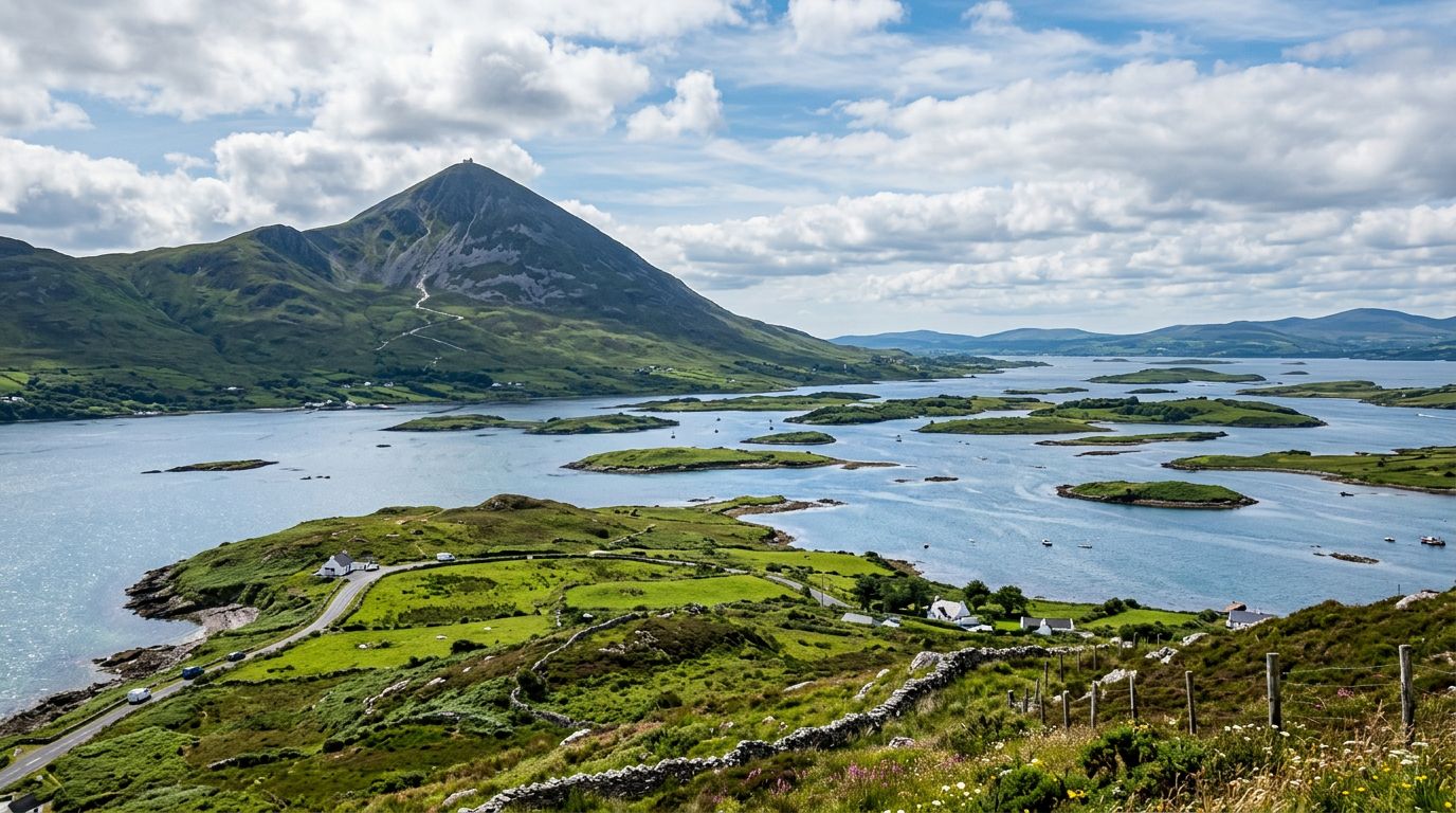
County Mayo is the wild heart of Ireland's west coast — the third-largest county, with the longest coastline on the Wild Atlantic Way and some of the most dramatic landscape in the country. Westport, the Georgian town at the head of Clew Bay, is the natural base for exploring a county that stretches from holy mountains to sea cliffs to 5,000-year-old farmland. Croagh Patrick, Ireland's holy mountain, rises 764 metres above Westport and Clew Bay. The 7-kilometre round-trip climb is one of the most iconic hikes in Ireland, rewarding those who reach the summit with views of Clew Bay and its reputed 365 islands. The final section is loose scree and genuinely challenging, but lower viewpoints offer spectacular panoramas for those who prefer a shorter walk. Reek Sunday (the last Sunday in July) draws up to 30,000 pilgrims. Achill Island — Ireland's largest offshore island, connected to the mainland by a bridge — sits an hour west of Westport. Keem Bay, at the island's western tip, is a Blue Flag beach reached by a dramatic cliff-edge road. The beach appeared in the 2022 film The Banshees of Inisherin. The Atlantic Drive loops the southern coast with views of sea cliffs, and the deserted village on the slopes of Slievemore mountain is one of the most evocative famine-era ruins in the country. The Great Western Greenway — a 42-kilometre off-road cycling and walking trail — connects Westport to Achill Island through countryside, coastal views, and the village of Newport. Bike hire is available at both ends. In North Mayo, the Céide Fields near Ballycastle are the world's oldest known stone-walled field system, dating back over 5,000 years. Preserved under blanket bog, the Neolithic farmland is interpreted through a visitor centre perched on the cliff edge with dramatic Atlantic views. Downpatrick Head, nearby, has the sea stack Dún Briste — a massive column of rock separated from the mainland by Atlantic storms.
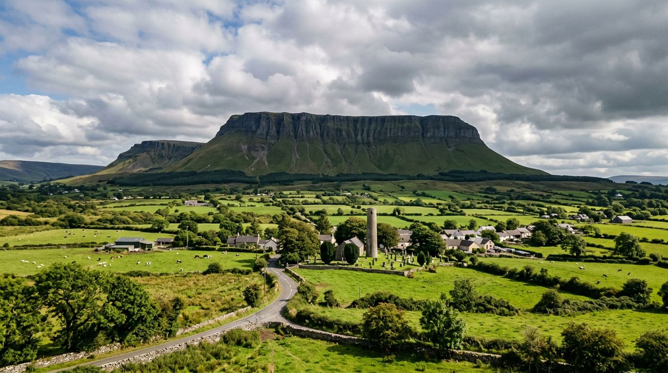
Sligo
County Sligo is Yeats Country — the landscape that inspired Nobel laureate W.B. Yeats and shapes virtually every visitor experience in the county. The connection is not sentimental: Sligo's mountains, lakes, and coastline appear in the poems themselves, and the Yeats Trail — a signposted touring route connecting 14 locations — threads through the sites that fired some of the most celebrated poetry in the English language. Benbulben is the county's defining landmark — a flat-topped, cliff-faced mountain rising 526 metres above the plain north of Sligo town. Its distinctive profile appears in photographs and paintings worldwide. At its foot, the churchyard at Drumcliff holds the grave of W.B. Yeats, inscribed with his own epitaph: "Cast a cold eye / On life, on death. / Horseman, pass by!" Across the bay from Benbulben, Knocknarea (327 metres) is crowned by Miosgán Méabha — a massive cairn on the summit traditionally identified as the tomb of the legendary Queen Maeve of Connacht. The walk to the summit takes about 40 minutes from the car park at Strandhill and is one of the most accessible and rewarding short hikes in the west. Strandhill, at the foot of Knocknarea, is the surf capital of the northwest. The National Surf Centre is based here, and the beach draws surfers year-round. Voya Seaweed Baths — heated seaweed baths overlooking the Atlantic — are a popular complement to the surf scene. Carrowmore, on the outskirts of Sligo town, is one of the largest and oldest megalithic cemeteries in Europe — over 60 tombs and passage graves dating back more than 5,000 years. The visitor centre interprets the site, and many of the tombs are freely accessible in the surrounding fields. Lough Gill, east of Sligo town, is the lake that inspired Yeats's poem "The Lake Isle of Innisfree." Boat trips circle the lake, passing the tiny island of Innisfree. Lissadell House — a 19th-century country house associated with the Gore-Booth sisters and Yeats — sits on the coast between Drumcliff and Benbulben.
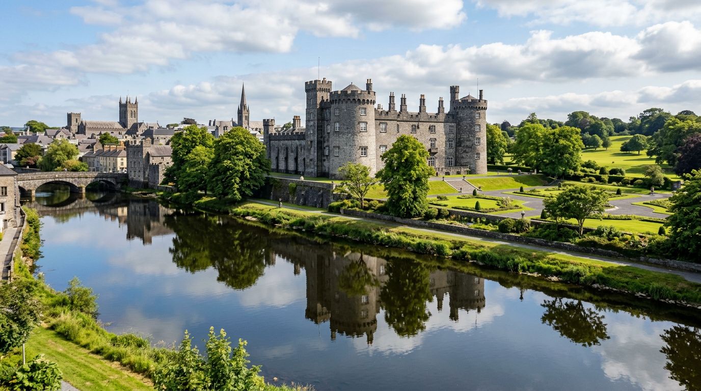
Kilkenny
Kilkenny is Ireland's best-preserved medieval city, a compact, walkable place where 800 years of history remain visible in the streets. The Medieval Mile — a heritage trail running roughly one kilometre from Kilkenny Castle at the southern end to St Canice's Cathedral and Round Tower at the northern end — is the spine of the city, threading through cobbled lanes lined with Tudor merchant houses, Gothic churches, and craft workshops. Kilkenny Castle dominates the southern skyline. Originally a Norman fortress built in the 12th century by William Marshall, son-in-law of the invader Strongbow, the castle was remodelled over centuries by the Butler family and sits today in 52 acres of parkland along the River Nore. Tours run year-round and cover the Long Gallery, the restored Victorian kitchens, and the medieval undercroft. Walking north along the Medieval Mile, you pass Rothe House — a 1594 Tudor merchant's townhouse with a courtyard garden — the Smithwick's Experience on Parliament Street (a 5-minute walk from the castle), the Medieval Mile Museum housed in the 13th-century St Mary's Church, and the Butter Slip, a narrow medieval lane. At the far end, St Canice's Cathedral offers one of only three climbable round towers in Ireland — 30 metres tall with panoramic views of the city and surrounding countryside. Beyond the city, the surrounding countryside holds some of Ireland's finest monastic ruins. Kells Priory — an extensive walled Augustinian priory, 15 minutes south — is often described as Ireland's most impressive monastic ruin outside of Glendalough. Jerpoint Abbey, 25 minutes south, has a carved Romanesque cloister that ranks among the finest medieval stonework in the country.
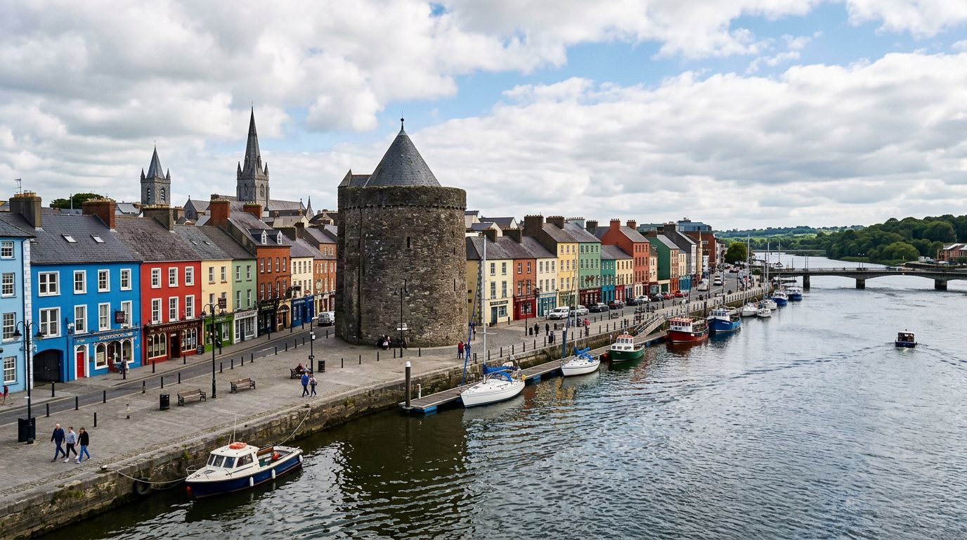
Waterford
Waterford is the oldest city in Ireland, founded by Vikings in 914 AD on the south bank of the River Suir. The city's cultural heart is the Viking Triangle — a compact medieval quarter of narrow streets centred on Reginald's Tower, the oldest civic building in Ireland, built in 1003 AD and the only urban monument in the country to retain its Norse name. The Viking Triangle holds three interconnected museums — Reginald's Tower, the Medieval Museum, and the Bishop's Palace — that together cover a thousand years of the city's history from Viking settlement to Georgian prosperity. A combined ticket covers all three. The Waterford Crystal visitor experience, housed in the modern factory on the Mall, offers tours of the workshop where craftspeople cut, blow, and engrave the crystal by hand. West of the city, the Copper Coast stretches 25 kilometres between Tramore and Dungarvan. Designated a UNESCO Global Geopark, this stretch of coastline takes its name from the 19th-century copper mines carved into its cliffs. The drive passes through a sequence of beaches, coves, and villages — Annestown, Bunmahon, Stradbally — each with its own character. The Tankardstown Engine House, a ruined mining structure on the clifftop, is the Copper Coast's most recognisable landmark. The Waterford Greenway — a 46-kilometre off-road cycling and walking trail between Waterford city and Dungarvan — follows a disused railway line through countryside, over a Victorian viaduct, and through a 400-metre tunnel. Bike hire is available at both ends and at several points along the route. Inland, the heritage town of Lismore sits on the River Blackwater, 30 minutes from Dungarvan. Lismore Castle, originally a 12th-century monastery, dominates the town from above. The castle gardens — separate from the castle itself — are open to visitors and feature contemporary art installations among heritage plantings.
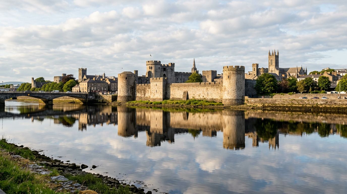
Limerick
Limerick is Ireland's third city and the gateway to the midwest, sitting at the lowest crossing point of the River Shannon. The medieval core of the city clusters around King's Island, where King John's Castle — a 13th-century Anglo-Norman fortress built between 1200 and 1210 — dominates the riverside skyline. The castle's immersive exhibitions, excavated Viking-era foundations, and panoramic views from its towers make it the city's centrepiece attraction, open seven days a week year-round. Across Thomond Bridge from the castle, the Treaty Stone marks where the 1691 Treaty of Limerick was signed, ending the Williamite-Jacobite War and giving Limerick its enduring nickname: the Treaty City. St Mary's Cathedral, founded in 1168, is the oldest in-situ building in the city. The Hunt Museum, housed in the 18th-century Custom House on Rutland Street, holds one of Ireland's most important private collections of art and antiquity. Twenty minutes south of the city, the village of Adare is regularly cited as Ireland's prettiest village. Its neat rows of 19th-century thatched cottages, medieval priories (Augustinian, Franciscan, and Trinitarian), and the Gothic Revival Adare Manor — now a luxury hotel and golf resort — make it a natural stop on any Limerick itinerary. Lough Gur, 30 minutes southeast of the city, is one of Ireland's most important archaeological landscapes. The horseshoe-shaped lake is ringed by monuments spanning 6,000 years of continuous human settlement, including the Grange Stone Circle — roughly 45 metres in diameter, the largest stone circle in Ireland — crannógs, ring forts, and the remains of Stone Age dwellings. The heritage centre interprets the site with an audio-guided lakeside trail. The Limerick Greenway — a 39-kilometre off-road cycling and walking trail along a former railway line — connects Rathkeale, Newcastle West, and Abbeyfeale through gentle countryside. Bike hire is available at multiple points along the route.
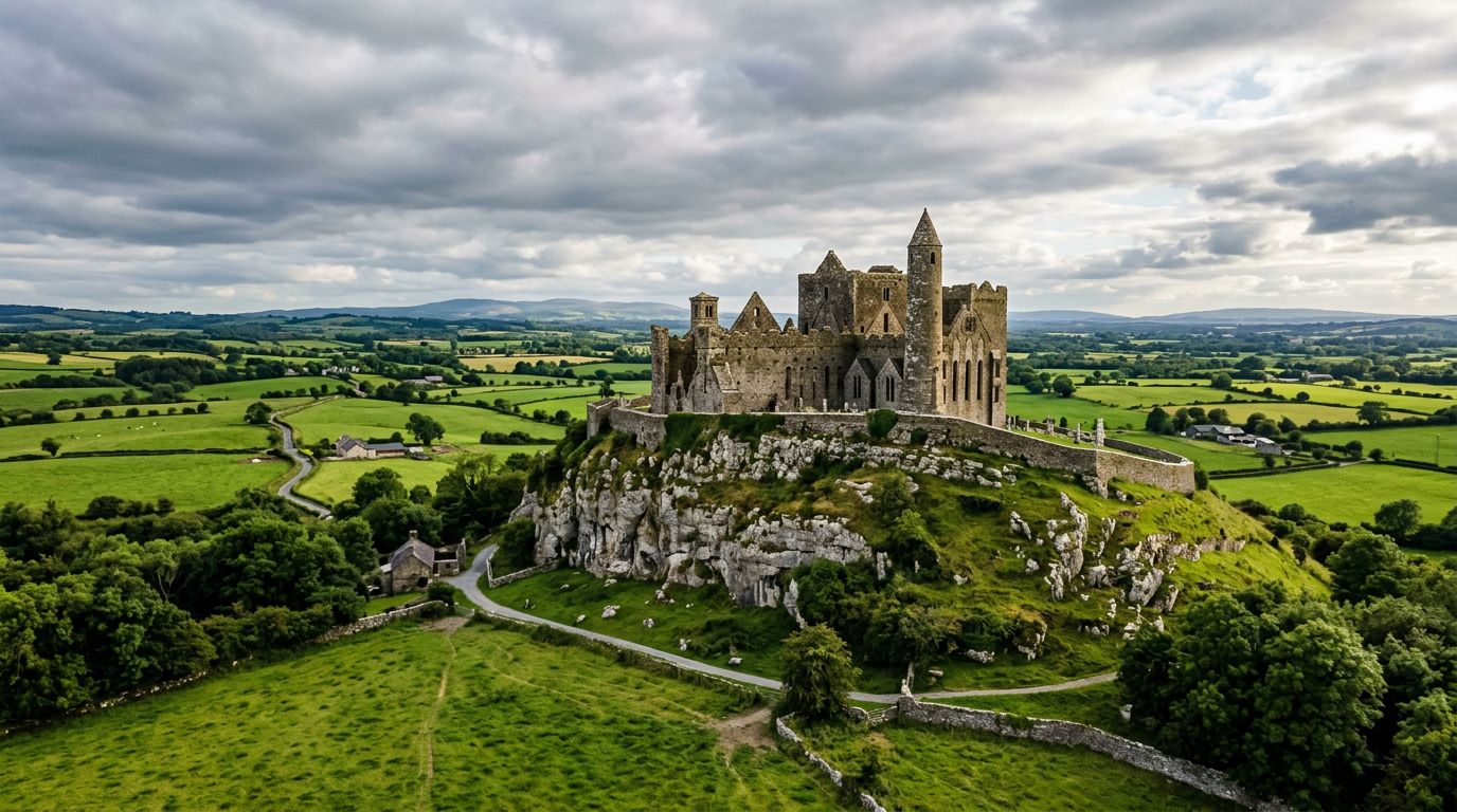
Tipperary
County Tipperary is Ireland's largest inland county, centred on the Golden Vale — the richest farmland on the island — and anchored by two of the country's most dramatic historical sites: the Rock of Cashel and Cahir Castle. The Rock of Cashel rises from the flat plain of the Golden Vale on a limestone outcrop visible for miles in every direction. This medieval complex was the seat of the Kings of Munster from the 4th century and includes Cormac's Chapel (1127–1134, a Romanesque masterpiece with the oldest surviving frescoes in Ireland), a 13th-century Gothic cathedral, a 28-metre round tower, and the Hall of the Vicar's Choral. The site is managed by the OPW and open year-round. Below the Rock, the roofless ruins of Hore Abbey — a 13th-century Cistercian foundation — sit in fields accessible via a short walk. Cahir Castle, 20 minutes south, is one of Ireland's largest and best-preserved medieval castles. Built on a rocky island in the River Suir by the Butler family, the castle retains its three wards (inner, middle, outer), massive keep, and curtain walls in remarkably complete condition. Guided tours run regularly. Near Cahir, the Swiss Cottage — an ornamental cottage orné designed by John Nash in the early 19th century — is a curiosity worth the short detour. The Glen of Aherlow, southwest of Cahir, is a scenic valley running 16 kilometres between the Galtee Mountains (Ireland's highest inland range, with Galtymore at 919 metres) and the wooded ridge of Slievenamuck. The Christ the King statue viewpoint offers one of the finest panoramas in Munster. Walking trails range from gentle forest loops to the challenging Galtymore summit hike. Holy Cross Abbey, 25 minutes north of Cashel, is a restored 12th-century Cistercian abbey — one of the few medieval churches in Ireland still in active use as a parish church.
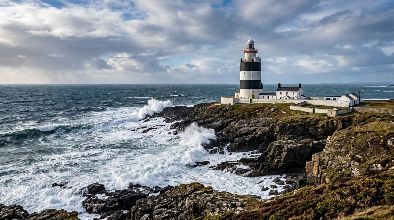
Wexford
County Wexford occupies the southeastern corner of Ireland, earning its reputation as the sunniest county thanks to Ireland's highest average sunshine hours. The county's defining feature is the Hook Peninsula — a finger of land pointing into the Celtic Sea, crowned by Hook Lighthouse, the oldest intact operational lighthouse in the world. Hook Lighthouse was purpose-built in the early 13th century by the Norman knight William Marshal. Its black-and-white striped tower rises 24 metres above the headland, and guided tours climb 115 steps to a balcony with 360-degree views of the Wexford and Waterford coastline. The Ring of Hook — a signposted coastal driving loop of roughly 72 kilometres — circles the peninsula past Tintern Abbey (a Cistercian foundation from 1200), Duncannon Fort (a star-shaped 16th-century harbour defence), Ballyhack Castle, and the ruined village of Slade. Inland, Johnstown Castle is a Gothic Revival estate 6 kilometres from Wexford town. The castle's turrets and ornamental lake sit in 50 acres of gardens managed by the Irish Heritage Trust. Inside, guided tours reveal the castle's restored interiors, while the Irish Agricultural Museum in the grounds covers rural Irish life through 19 exhibition spaces. The Irish National Heritage Park at Ferrycarrig, on the edge of Wexford town, is an open-air museum reconstructing 9,000 years of Irish settlement across 35 acres — from Stone Age camps and Bronze Age cooking sites to a Viking longhouse and a Norman motte-and-bailey. Three guided tours (Prehistoric, Early Christian, and Age of Invasion) bring the reconstructions to life. In New Ross, 30 minutes west, the Dunbrody Famine Ship is a full-scale replica of the 1845 emigrant vessel, offering an interactive experience of the famine emigration story. Nearby, the JFK Homestead — the ancestral home of President John F. Kennedy — sits in the countryside 8 kilometres south.
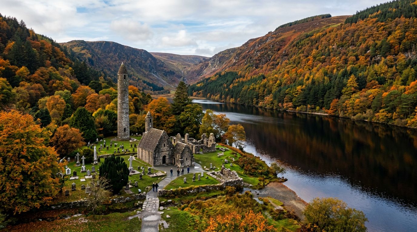
Wicklow
County Wicklow begins where Dublin ends, its mountain spine rising within 20 minutes of the M50 ring road. Known as the Garden of Ireland, the county combines upland wilderness — heather-clad bog, glacial lakes, and two of the highest mountain passes in eastern Ireland — with manicured estate gardens and one of the most complete early Christian monastic sites in the country. Glendalough, the Valley of Two Lakes, is Wicklow's centrepiece. Founded by St Kevin in the 6th century, the monastic settlement sits in a glacial valley flanked by steep oak-wooded slopes and two dark lakes. A 30-metre round tower, three stone churches, and a carved stone cross survive from the medieval period, and the site is freely accessible year-round. The Spinc walk — a 9-kilometre loop above the Upper Lake — climbs 300 metres to a wooden boardwalk ridge with the best views in Wicklow. For a gentler walk, the Poulanass Waterfall trail (3 kilometres, 90 minutes) follows the lakeshore. Powerscourt Estate, near the village of Enniskerry 25 kilometres south of Dublin, holds 47 acres of formal gardens laid out with Italianate terraces, Japanese gardens, and views of the Sugar Loaf mountain. The separate Powerscourt Waterfall — 6 kilometres from the main house — drops 121 metres, making it the highest waterfall in Ireland. The Sally Gap and the Wicklow Gap are the two mountain passes that cross the Wicklow Mountains. The Sally Gap road (R115/R759) climbs through open moorland past the dark waters of Lough Tay — often called the Guinness Lake for its dark water and white sand beach — before descending toward Glendalough. A full scenic loop from Dublin over both passes with Glendalough in between covers roughly 120 kilometres and fills a relaxed day.
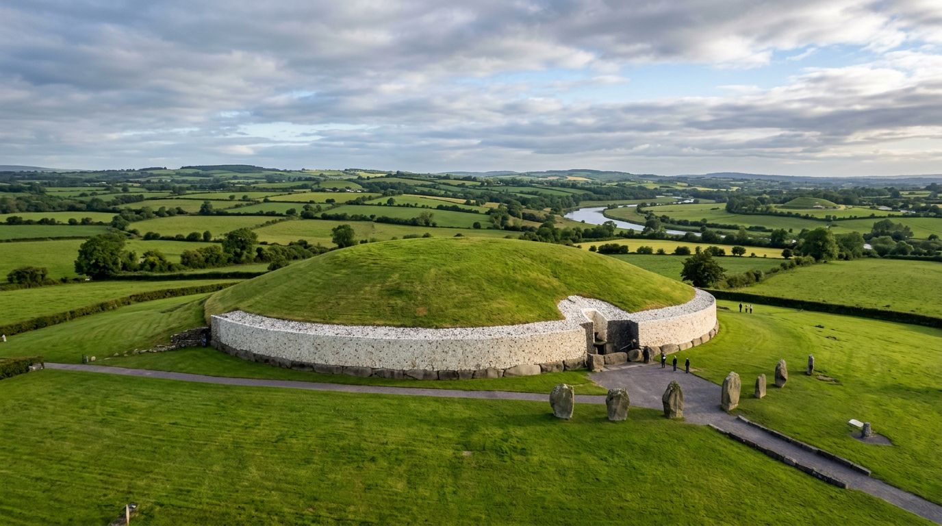
Meath
County Meath is Ireland's royal county — the landscape where five millennia of power, ritual, and belief left their mark in passage tombs, hill forts, and castle walls. The Boyne Valley, which runs through the heart of the county, holds the densest concentration of prehistoric and historic monuments on the island, including a UNESCO World Heritage Site older than Stonehenge and the Egyptian pyramids. Brú na Bóinne — the Palace of the Boyne — is the collective name for the three great passage tombs of Newgrange, Knowth, and Dowth, built around 3200 BC. Newgrange is the most famous: a grass-covered mound 85 metres in diameter and 13 metres high, with an inner chamber aligned so that a shaft of sunlight penetrates the roof box and illuminates the passage floor at dawn on the winter solstice. Access to Newgrange and Knowth is strictly through the Brú na Bóinne Visitor Centre — no private vehicles can approach the tombs, and tours must be booked in advance, especially from May to September. The Hill of Tara, 20 minutes south of Brú na Bóinne, was the inauguration site and ceremonial seat of the High Kings of Ireland. The hilltop holds the remnants of passage tombs, ring forts, and the Lia Fáil (Stone of Destiny), which, according to legend, would roar when touched by the rightful king. The site is freely accessible year-round, with guided tours available from the visitor centre in summer. Trim Castle, 30 minutes west of Tara, is the largest Anglo-Norman castle in Ireland. Built in 1172 by Hugh de Lacy, it was famously used as a filming location for the 1995 movie Braveheart. The town of Trim itself preserves a medieval street layout with the Yellow Steeple and Talbot Castle adding to the heritage. The Battle of the Boyne site at Oldbridge, between Brú na Bóinne and Drogheda, marks where William of Orange defeated King James II in 1690 — a turning point in Irish and European history. The visitor centre and restored 18th-century manor make this an accessible and well-interpreted stop. Further north, Monasterboice — a free-access monastic site near Drogheda — holds two of the finest high crosses in Ireland, carved with biblical scenes in the 10th century.
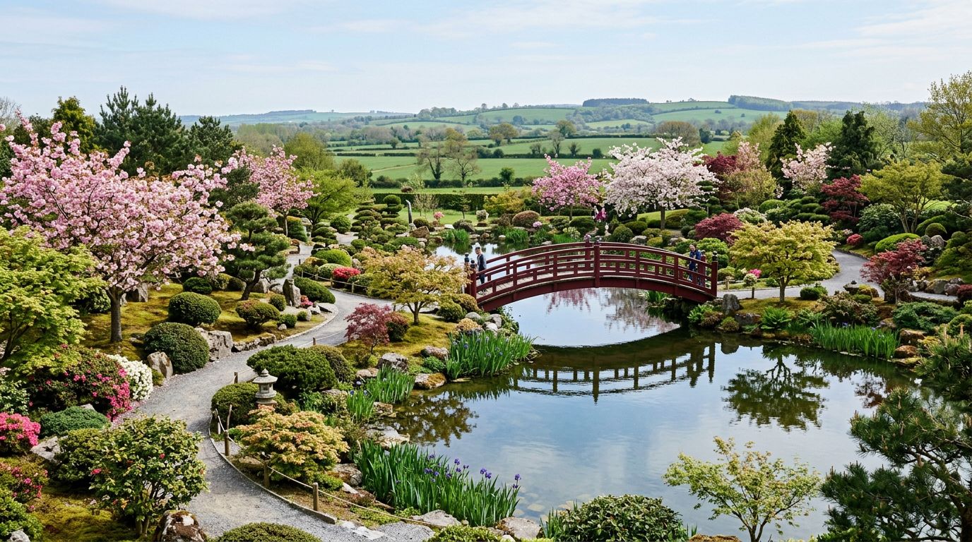
Kildare
County Kildare is the heart of Ireland's thoroughbred industry — flat green pastures that have produced champions for generations, anchored by three landmark attractions within easy reach of Dublin. The Irish National Stud & Gardens sits just outside Kildare town. This working stud farm is the only one in Ireland open to the public, offering visitors the chance to see stallions worth tens of millions of euros alongside mares and foals in their paddocks. The site holds four attractions on one ticket: the stud farm itself, the Japanese Gardens (created between 1906 and 1910 by Japanese master horticulturist Tassa Eida for Colonel William Hall-Walker, and ranked among the finest in Europe), St Fiachra's Garden (a contemplative space commemorating the patron saint of gardeners), and the Irish Racehorse Experience — an interactive exhibition covering the sport from foal to finishing post. The Curragh Racecourse, five minutes north, is Ireland's oldest and most famous track. Racing has taken place here since the 18th century, and the course hosts all five Irish flat-racing Classics, including the Irish Derby (run since 1866). The vast open plain of the Curragh — nearly 5,000 acres of common land — is itself a defining feature of the Kildare landscape, with trainers' horses grazing freely alongside the road. Castletown House in Celbridge, at the county's northern edge, is Ireland's earliest and largest Palladian mansion. Built between 1722 and 1729 for William Conolly, Speaker of the Irish House of Commons, the house was designed by Alessandro Galilei with wings by Edward Lovett Pearce. Its interiors include three 18th-century Murano-glass chandeliers and the only fully intact 18th-century print room in the country. The 18th-century parklands are free to enter and open year-round. Kildare town itself has the second-tallest round tower in Ireland (32.6 metres) at St Brigid's Cathedral, and Kildare Village — a designer outlet shopping centre — draws visitors from Dublin and beyond.
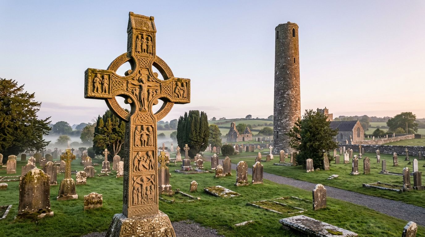
Louth
County Louth is Ireland's smallest county but one of its most historically dense. Sitting on the corridor between Dublin and Belfast, it packs 5,000 years of heritage into a compact landscape of medieval towns, monastic sites, and a wild coastal peninsula. Monasterboice, 10 kilometres north of Drogheda, is one of the most important early Christian sites in Ireland. The monastery was founded in the 5th century by St Buithe, a disciple of St Patrick, and its two great high crosses are extraordinary works of stone carving. Muiredach's Cross — dating from the early 10th century, standing 5.5 metres tall — is considered one of the finest surviving examples of Irish religious art, its panels depicting Old Testament scenes carved for a population that could not read. The West Cross (the Tall Cross), at roughly 7 metres, is the highest high cross in Ireland. A round tower and the ruins of two churches complete the site, which is freely accessible year-round. Carlingford is the jewel of County Louth — a small walled medieval town on the southern shore of Carlingford Lough, with the Cooley Mountains rising steeply behind and the Mourne Mountains of Northern Ireland across the water. King John's Castle (a 12th-century Norman fortress) overlooks the harbour, and the intact medieval streetscape includes the Mint, the Tholsel, and Taafe's Castle. The town is renowned for its restaurants and for Carlingford Oysters. The Cooley Peninsula rises behind Carlingford to over 500 metres at Slieve Foye (588 metres, the county's highest point). The Táin Way — a 40-kilometre long-distance walking route — circles the peninsula through the landscape of the Táin Bó Cúailnge (the Cattle Raid of Cooley), one of the oldest vernacular narratives in Western Europe. Old Mellifont Abbey, 10 kilometres northwest of Drogheda, was the first Cistercian monastery in Ireland, founded in 1142 by St Malachy of Armagh. Its defining feature is the 13th-century octagonal lavabo — the finest preserved medieval lavabo in Ireland — where monks washed their hands before meals. The 14th-century chapter house retains its vaulted ceiling. Drogheda itself offers Millmount Museum, St Laurence's Gate (one of the finest medieval town gates in Europe), and the Boyne Greenway connecting to the Battle of the Boyne site at Oldbridge.
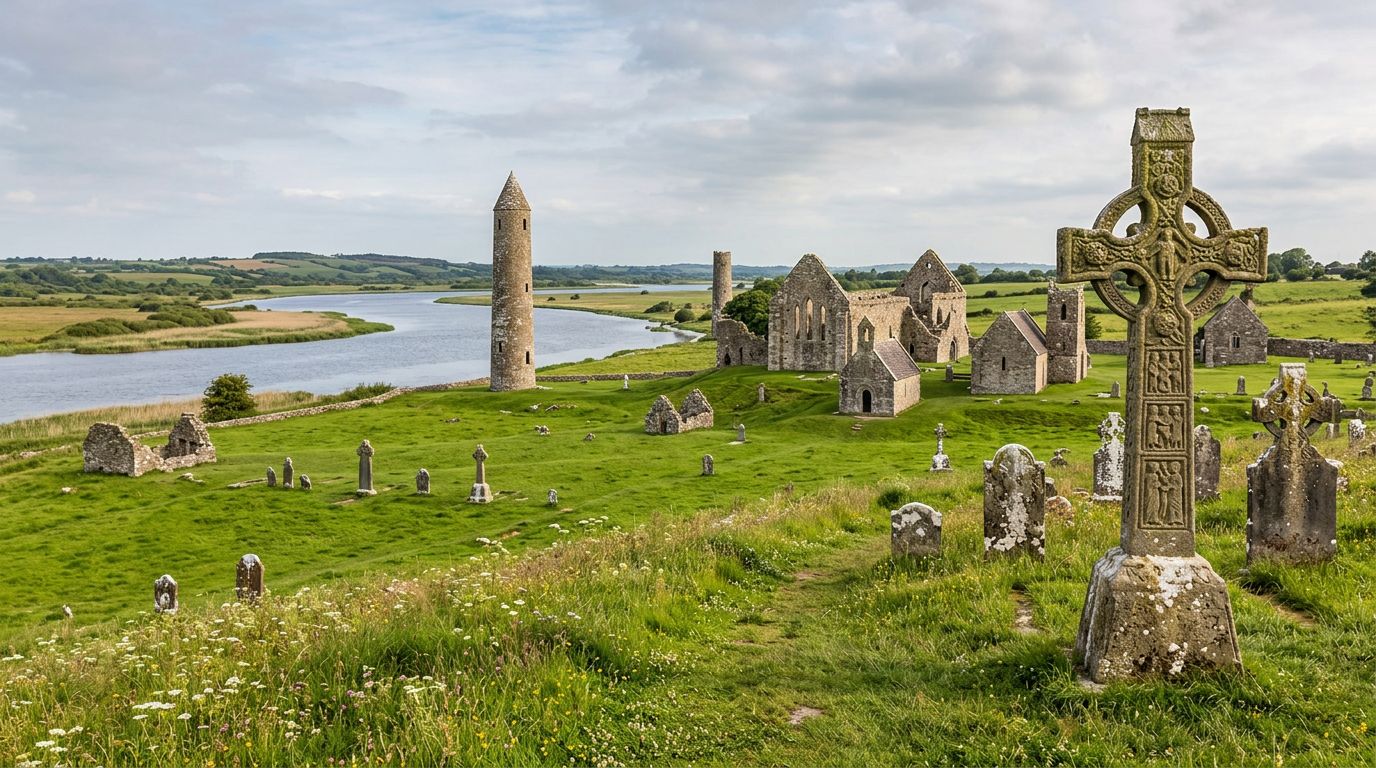
Offaly
County Offaly sits at the heart of Ireland along the River Shannon, holding some of the country's most remarkable heritage and nature in a landscape of bogland, river meadows, and ancient mountains. Clonmacnoise is Ireland's most important early Christian monastic site. Founded in 544 by St Ciarán on an esker ridge where the east-west road crossed the River Shannon, it grew into one of Europe's great centres of learning, producing manuscripts including the Book of the Dun Cow. The site today includes the ruins of a cathedral, seven churches (10th to 13th century), two round towers, three high crosses (the Cross of the Scriptures, carved c.900, is one of the finest in Ireland), and the largest collection of early Christian grave slabs in Western Europe. Note: the visitor centre is currently closed for renovation in 2026, but the outdoor site remains fully accessible. Birr Castle Demesne, in the heritage town of Birr, spans 120 acres of parklands and gardens with over 5,000 species of trees and plants. Its centrepiece is the Great Telescope — built by the third Earl of Rosse in the 1840s, it was the largest telescope in the world for 70 years. Ireland's Historic Science Centre on the grounds explores the Parsons family's contributions to astronomy, photography, and engineering. The gardens include the world's tallest box hedges and Ireland's tallest treehouse. Lough Boora Discovery Park is a rehabilitated peatland that has been transformed into an ecological and recreational asset. The park's award-winning Sculpture Park features 24 works created from industrial bog materials. Cycling and walking trails weave through wetlands, grasslands, and lakes where over 940 species have been recorded. The Slieve Bloom Mountains — shared with neighbouring Laois — are among the oldest mountain ranges in Ireland (roughly 400 million years old). The highest point, Arderin (527 metres), offers views across five counties. The Slieve Bloom Way is a 70-kilometre waymarked loop through the mountains.
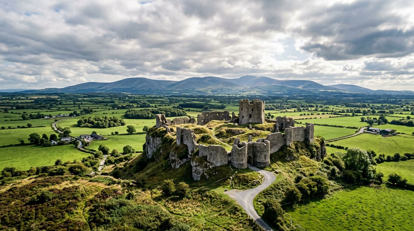
Laois
County Laois (pronounced "Leesh") is one of Ireland's least-visited counties — and one of its most rewarding for visitors who value architecture, heritage, and a pace of travel unbothered by crowds. The Rock of Dunamase is the county's most dramatic sight — a ruined hilltop fortress on a limestone outcrop between Portlaoise and Stradbally, standing 46 metres above the surrounding flat countryside with uninterrupted views toward the Slieve Bloom Mountains. The castle ruins date from the Norman period (associated with Strongbow's marriage alliance) but the site has been occupied since at least the 9th century. The climb to the top is short but steep, and the panoramic reward is one of the finest viewpoints in the midlands. Emo Court is a neoclassical mansion designed by James Gandon (the architect of Dublin's Custom House) in 1790. Its domed rotunda, inspired by the Pantheon in Rome, is the centrepiece of a house set in 250 acres of parkland managed by the OPW. The mile-long Wellingtonia Avenue, the 25-acre lake, and the arboretum with rare trees (including Bhutan Pine, Tulip Tree, and Blue Atlas Cedar) are open year-round with no admission fee. Guided tours of the house run seasonally. Heywood Gardens, 25 minutes south near Ballinakill, is a formal landscape designed by Sir Edwin Lutyens — one of the few Lutyens gardens in Ireland. Terraces, pergolas, and a sunken garden create an Italianate atmosphere that is peaceful and rarely crowded. Abbeyleix is one of Ireland's finest planned estate towns. Established in the 1770s by the de Vesci family, who relocated the original village to higher ground, the town preserves its Georgian streetscape and heritage character. Heritage House is a community-run museum telling the town's story, and Morrissey's pub — dating to 1770, with its original fittings and shop counters — is a landmark in its own right. The town was designated a Heritage Town of Ireland. The Slieve Bloom Mountains form the county's western border (shared with Offaly), with the Glenbarrow waterfall trail and the 70-kilometre Slieve Bloom Way accessible from the Laois side.
Westmeath
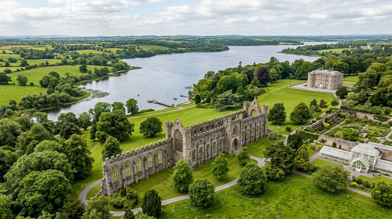
County Westmeath sits at the centre of Ireland, anchored by the towns of Athlone and Mullingar and defined by a landscape of lakes, Georgian estates, and medieval curiosities. Athlone Castle is a 12th-century fortification built for King John on the River Shannon — the strategic crossing point at the heart of Ireland. The castle's interactive visitor centre relives the Great Siege of 1691 in a 360-degree cinematic experience. Note: the castle is currently closed for redevelopment with an anticipated reopening in Autumn 2026, but its imposing exterior remains a centrepiece of the town. Belvedere House and Gardens, 6 kilometres south of Mullingar on the shores of Lough Ennell, is a Georgian hunting lodge set in a 65-hectare parkland estate. The house itself features extraordinary rococo ceilings and a scandalous family history involving the first Earl of Belvedere imprisoning his wife for 31 years. The Jealous Wall — a Gothic folly built to block the view of a rival brother's house — is one of Ireland's most remarkable architectural curiosities. The estate's woodland walks around Lough Ennell are peaceful and well-maintained. Fore Abbey, 26 kilometres north of Mullingar in the Fore Valley, is a 7th-century monastic settlement founded by St Fechin around AD 630. The site is the largest Benedictine foundation in Ireland and is associated with the legendary Seven Wonders of Fore — including water that will not boil, wood that will not burn, and a mill without a race. A 3-kilometre looped trail circles the valley past the ruins. Kilbeggan Distillery, on the River Brosna between Athlone and Mullingar, is the world's oldest continuously licensed whiskey distillery, established in 1757. The distillery is a working production site where visitors can tour the original waterwheel, pot stills, and warehouses before tasting in the Warehouse Bar.
Roscommon
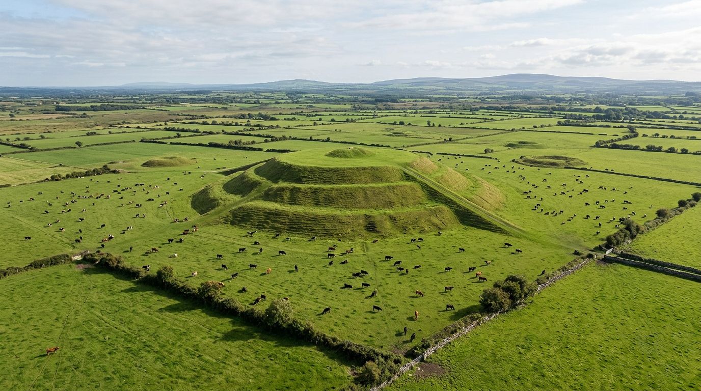
County Roscommon is one of Ireland's quietest counties — a landscape of rolling pasture, bog, and lake where some of the island's most significant archaeological and heritage sites sit largely undisturbed by coach-tour traffic. Rathcroghan, near Tulsk village, was the ancient capital of the province of Connacht and is the oldest and largest unexcavated Royal Site in Europe. This complex of over 240 archaeological monuments spans 6,000 years of continuous settlement. Oweynagat — the "Gates of Hell" cave — is associated with the origins of Samhain and Halloween, and with the legendary Warrior Queen Medb and the Táin Bó Cúailnge (the Cattle Raid of Cooley). The Rathcroghan Visitor Centre in Tulsk offers archaeologist-guided tours that bring the landscape's mythology and archaeology together. Strokestown Park House and the National Famine Museum occupy a Palladian mansion that was home to the Packenham Mahon family. Major Denis Mahon was the first landlord assassinated during the Great Famine, and the estate holds some of the most meticulous famine-era records in Ireland. The house is open daily 10:30–17:00, with guided tours at 12pm and 2pm. Walled gardens and woodland trails surround the property, and the National Famine Way — a 165-kilometre walking trail to Dublin — begins here. Boyle Abbey is a 12th-century Cistercian monastery founded in 1161 and consecrated in 1218, a daughter house of Mellifont Abbey with MacDermott patronage. Unusually for a Cistercian foundation, the abbey features carved corbels and capitals. A restored 16th/17th-century gatehouse contains an exhibition. The site is managed by the OPW and sits off the N4 Dublin–Sligo road — allow roughly one hour for a visit. Lough Key Forest Park, near Boyle, is the county's outdoor hub — trails, the Boda Borg challenge course, Zipit high-ropes, and boat trips to Castle Island. The park is open daily 10:00–18:00 with parking at €6. Roscommon Castle is a 13th-century Norman ruin in Roscommon town, and King House in Boyle is a Georgian mansion now operating as a cultural centre.
Leitrim
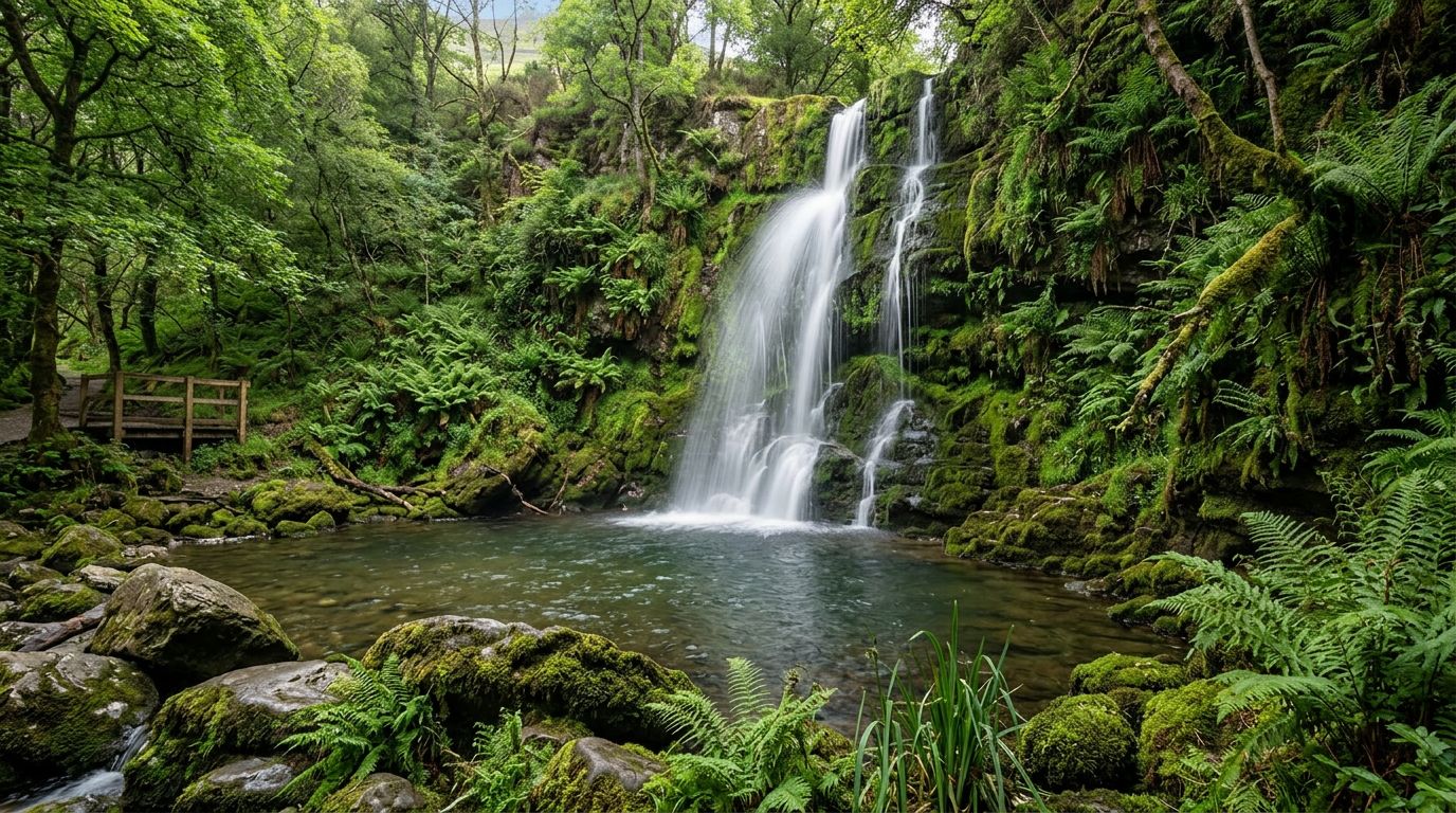
County Leitrim is Ireland's least populated county and one of its best-kept secrets — a landscape of lakes, rivers, and mountain valleys with just 2.5 kilometres of coastline (the shortest in Ireland). For visitors seeking uncrowded, authentic Ireland, Leitrim delivers. Glencar Waterfall is a 15-metre cascade near Glencar Lake, 11 kilometres west of Manorhamilton. It inspired W.B. Yeats's poem "The Stolen Child" ("Come away, O human child / To the waters and the wild"). The site has a car park, picnic area, and tea room — a peaceful stop that most tourists never reach. Parke's Castle is a restored 17th-century plantation castle on the shores of Lough Gill, managed by the OPW with guided tours. Rose of Innisfree boat tours to Innisfree island depart from here (Wednesdays from July 2026). The castle is open seasonally March through October. Carrick-on-Shannon is the county town and a vibrant riverside hub on the River Shannon — river cruises, restaurants, and Ireland's Tidiest Town 2026. It is the main hub for equipment hire and accommodation in the county. The Shannon Blueway spans 146.5 kilometres of trails. The Drumshanbo to Carrick-on-Shannon section covers 16.5 kilometres of paddling plus 10 kilometres of walking and cycling. Acres Lake Boardwalk in Drumshanbo is Ireland's first floating boardwalk — 600 metres total, with 160 metres floating over the lake. Kayak, canoe, and SUP hire are available locally. Glenade Valley in North Leitrim offers dramatic mountain and lake scenery, and Lough Rynn Castle Estate near Mohill has gardens and woodland walks open to visitors.
Cavan
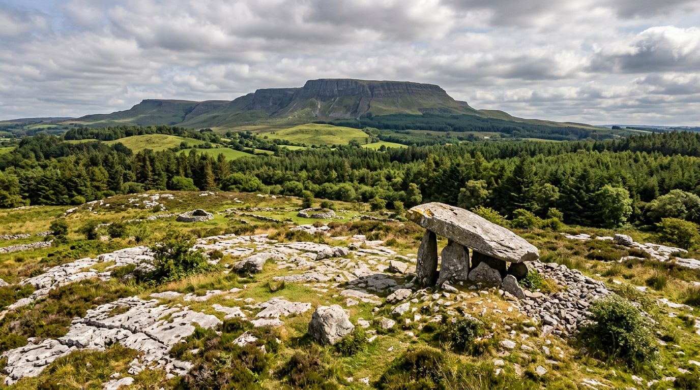
County Cavan is Ireland's "lakeland county" — a landscape of over 365 lakes (traditionally, one for every day of the year) set among drumlin hills, limestone plateaus, and the southern slopes of the Cuilcagh Mountains. It is uncrowded, authentic, and deeply connected to both Ireland's ancient past and its living waterways. Cavan Burren Park is a prehistoric relict landscape on a limestone plateau beneath Cuilcagh Mountain. The park contains over 80 archaeological monuments — megalithic tombs, portal tombs, stone circles, and rock art — on 10 kilometres of trails across four looped walks. An interpretive centre explains the landscape's significance. The park is free, open year-round, and forms part of the Cuilcagh Lakelands UNESCO Global Geopark. It sits 4 kilometres south of Blacklion. Killykeen Forest Park, on the shores of Lough Oughter, offers woodland trails, lakeside views, kayaking, and family activities in one of the county's most accessible outdoor settings. The Shannon Pot is the traditional source of the River Shannon — a deep, aquifer-fed circular pool where Ireland's longest river begins its 360-kilometre journey to the Atlantic. It sits on the Cavan Way, a 26-kilometre walking route through the county's lakeland landscape. Clough Oughter Castle is a 13th-century round castle ruin on an island in Lough Oughter — one of the most photogenic heritage sites in the lakelands, accessible by boat or visible from the shore. Marble Arch Caves, just across the border in County Fermanagh (Northern Ireland), are closely linked to Cavan's geopark — show caves with an underground river boat trip through one of Ireland's finest cave systems.
Monaghan
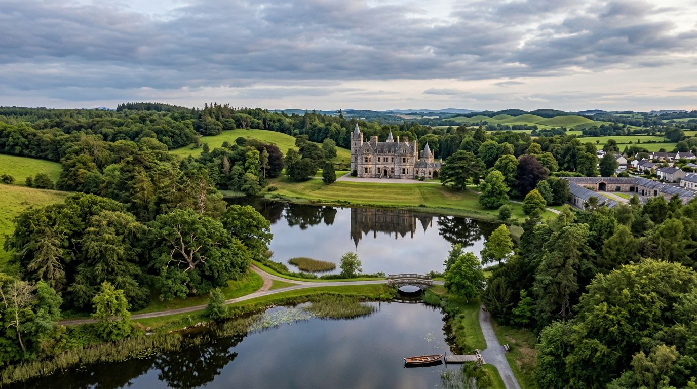
County Monaghan is Ireland's drumlin county — a landscape of rolling green hills and small lakes that feels a world away from the coach-tour circuit. It is uncrowded, authentic, and deeply connected to one of Ireland's greatest poets and one of its last great castle estates. The Patrick Kavanagh Centre in Inniskeen is housed in a deconsecrated 18th-century St Mary's Church — Kavanagh's birthplace village (1904–1967). The immersive exhibition covers his life and poetry, including "On Raglan Road" and "The Great Hunger". Self-guided, guided, and deluxe guided tours are available. The Kavanagh Trail connects 10 sites around Inniskeen, and the poet's grave sits in the adjoining churchyard. Castle Leslie Estate in Glaslough village spans 1,000 acres — the Leslie family has held the estate since the 1660s, making it the last great Irish castle estate still in founding family hands. The world-class equestrian centre, Victorian Treatment Rooms spa, and Snaffles Restaurant draw visitors from Dublin and Belfast. Accommodation spans The Castle (21 rooms), The Lodge (50 rooms), and Old Stable Mews. The estate is 80 minutes from Dublin and 60 minutes from Belfast. Monaghan County Museum in Monaghan town was the first full-time professionally staffed local authority museum in Ireland (opened 1974) — archaeological artefacts and heritage exhibitions in a compact, authoritative setting. The Glaslough Heritage Trail is a 2-kilometre walking trail through the village and Castle Leslie estate. Rossmore Forest Park, 3.5 kilometres from Inniskeen, offers woodland walks in a peaceful setting.
Longford
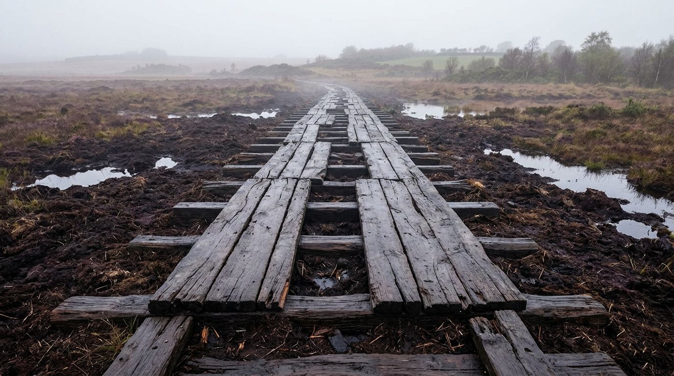
County Longford is one of Ireland's quietest and most overlooked counties — a flat midlands landscape of bog, canal, and gentle pasture where significant heritage sites sit largely undisturbed by tourism. For visitors completing a tour of all 30 Irish counties, Longford offers authentic, uncrowded rewards. The Corlea Trackway is an Iron Age bog road built in 148 BC — the largest prehistoric bog road in Europe. An 18-metre stretch of preserved oak is on display in a dedicated visitor building near Kenagh village, 15 kilometres from Longford town. Free admission, OPW managed. The trackway may have connected the Hill of Uisneach to Rathcroghan in neighbouring Roscommon — linking two of Ireland's most important ancient sites. St Mel's Cathedral dominates Longford town — a neoclassical landmark devastated by fire on Christmas morning 2009 and painstakingly restored and reopened. Free to visit year-round, the cathedral's restoration story is as compelling as its architecture. The Royal Canal Greenway is a 130-kilometre Dublin–Longford cycling and walking trail. The Longford section runs through Clondra to Abbeyshrule — flat, well-surfaced, and family-friendly. It is one of the best canal greenway experiences in Ireland. Ardagh Heritage Village, 14 kilometres from Longford town, is a picturesque estate village worth a brief stop. Center Parcs Longford Forest, a 400-acre woodland resort near Ballymahon, offers accommodation with subtropical swimming, forest spa, and outdoor activities — a family option rather than a primary heritage attraction.
FeaturedWild Atlantic Way
The Wild Atlantic Way is a 2,500-kilometre coastal driving route — the longest defined coastal touring route in the world — stretching from Malin Head in County Donegal to the Old Head of Kinsale in County Cork. It passes through nine counties and three provinces, hugging Ireland's Atlantic seaboard through some of the most dramatic coastal scenery in Europe. The route is marked by distinctive wave-shaped signposts and features over 150 official discovery points, each chosen for its coastal views, heritage, or wildlife. The highlights read like a greatest-hits of western Ireland: the Cliffs of Moher rising 214 metres above the Atlantic in Clare, the Skellig Islands off the Kerry coast, the wild bog of Connemara in Galway, the sea stacks and arches of Achill Island in Mayo, the 600-metre Slieve League cliffs in Donegal, and Malin Head — Ireland's most northerly point — where the Atlantic weather arrives first. The route divides naturally into five sections. The southwest (Kerry and Cork) takes in the Ring of Kerry, the Beara Peninsula, and Mizen Head. The midwest (Clare and Limerick) covers the Cliffs of Moher, the Burren, and Loop Head. The west (Galway and Mayo) passes through Connemara, the Aran Islands, and Achill Island. The northwest (Sligo, Leitrim, and Donegal) reaches Slieve League, Fanad Head Lighthouse, and the Inishowen Peninsula. Most travellers cover the full route in 10 to 14 days, though it can be tackled in shorter sections. The signposted discovery points make navigation straightforward, and the route mixes main roads with quieter coastal lanes that reward a slower pace.
FeaturedRing of Kerry
The Ring of Kerry is a 179-kilometre circular driving route around the Iveragh Peninsula in southwest Ireland, following the N71 and N70 roads through some of the most dramatic coastal and mountain scenery on the island. The route starts and ends in Killarney, threading through a string of towns and villages — Kenmare, Sneem, Caherdaniel, Waterville, Cahersiveen, Glenbeigh, and Killorglin — each with its own character and stopping points. Leaving Killarney, the road climbs through Killarney National Park past Torc Waterfall and the panoramic viewpoint at Ladies View before descending through Moll's Gap — the highest point on the route at 235 metres — into the colourful heritage town of Kenmare. From here the N70 hugs the coast westward through Sneem, a village of brightly painted houses on the Kenmare River estuary, and on to Caherdaniel, where Derrynane Beach and the Staigue Stone Fort reward a stop. The western reaches of the peninsula are the wildest. Waterville sits on a narrow strip between Ballinskelligs Bay and Lough Currane, and from here the Skellig Ring — an 18-kilometre detour off the main route — loops through Portmagee and past the Kerry Cliffs, where the rock drops 300 metres to the Atlantic and the Skellig Islands sit on the horizon. Off the coast, Skellig Michael rises 217 metres from the sea, a UNESCO World Heritage Site where sixth-century monks built a monastery on a rock pinnacle accessible only by boat between May and October. The northern arc of the Ring passes through Cahersiveen — the birthplace of Daniel O'Connell — and the seaside villages of Glenbeigh and Killorglin before returning to Killarney. The route can be driven without stopping in roughly 2.5 to 3 hours, but most visitors allow 7 to 10 hours with stops, and splitting it over two days opens up the detours that make the difference.
FeaturedDingle Peninsula
The Dingle Peninsula is the northernmost of Kerry's three Atlantic peninsulas, reaching further west into the ocean than any other point on the Irish mainland. It is a Gaeltacht area — Irish is the first language in many of the villages along the western coast — and this cultural identity shapes the peninsula's character as much as its geography. Dingle town sits roughly halfway along the peninsula's southern coast, a compact harbour town with a reputation for seafood, traditional music, and a social atmosphere that belies its small size. The narrow streets are lined with brightly painted pubs and restaurants, and on any evening of the week you can find live music in at least half a dozen venues. The harbour is the town's working heart — fishing boats land catches that appear on restaurant menus the same evening. West of Dingle, the Slea Head Drive is a 38-kilometre clockwise loop along the R559 that traces the peninsula's most dramatic coastline. The road passes Ventry Beach, the Iron Age promontory fort at Dunbeg, the Fahan group of beehive huts, and rounds Slea Head itself — the most westerly point, with views of the Blasket Islands sitting in the Atlantic. Dunquin Pier, a zigzag path cut into the cliff face, is the departure point for boats to Great Blasket Island. Gallarus Oratory, near the drive's end, is a perfectly preserved early Christian stone church shaped like an upturned boat. North of Dingle town, the Conor Pass (R560) climbs to 456 metres — one of the highest mountain passes in Ireland — through a glacial landscape of corrie lakes, hanging valleys, and bare rock. The summit car park offers views south over Dingle Bay and north to Brandon Bay and the Maharees. The pass road is narrow, steep, and not suitable for large vehicles.
FeaturedConnemara
Connemara occupies the western third of County Galway, a triangle of land between Galway Bay to the south, the Atlantic to the west, and Killary Harbour — Ireland's only fjord — to the north. It is a landscape defined by extremes: the Twelve Bens mountain range reaches 729 metres at Benbaun, while the surrounding blanket bog stretches unbroken to the horizon in every direction. Between them, a network of lakes, rivers, and stone walls creates a patchwork that has changed little in centuries. The N59 from Galway runs through the heart of Connemara, passing through Oughterard — the traditional gateway — and on to Clifden, roughly 80 kilometres and 75 minutes west. Clifden is Connemara's unofficial capital, a small hillside town of colourful shopfronts overlooking Ardbear Bay. From here, the Sky Road is a 16-kilometre loop along the coast with views across island-studded Clifden Bay that justify the drive alone. South of Clifden, the coastal villages of Roundstone, Ballyconneely, and the twin beaches of Dog's Bay and Gurteen Bay add a completely different character — white sand against the bog. Kylemore Abbey sits on the shore of Pollacappul Lough, 20 kilometres east of Clifden on the N59. Built in the 1860s as a private residence, it became a Benedictine monastery in 1920 and today is one of the most visited attractions in the west of Ireland. The adjacent Connemara National Park at Letterfrack — just 5 kilometres from the Abbey — offers Diamond Hill, a 442-metre peak with a well-maintained trail that climbs to panoramic views of the Twelve Bens, the coastline, and the Abbey itself. The full walk takes 2 to 3 hours. Connemara remains one of the largest Gaeltacht (Irish-speaking) areas in the country. In villages like Spiddal, Carraroe, and Carna along the southern coast, Irish is the first language of daily life. This cultural layer adds a dimension that no other region in the west matches.
FeaturedCauseway Coastal Route
The Causeway Coastal Route is a 120-mile (190-kilometre) driving route along the north coast of Northern Ireland between Belfast and Derry/Londonderry. Consistently rated among the world's greatest coastal drives, it combines dramatic geology, ruined clifftop castles, the nine Glens of Antrim, and a UNESCO World Heritage Site into a single linear journey. The Giant's Causeway is the route's centrepiece — a formation of roughly 40,000 interlocking basalt columns, formed by an ancient volcanic eruption, stepping down from the cliff into the North Atlantic. It is Northern Ireland's only UNESCO World Heritage Site and one of the most visited natural attractions in Ireland. The visitor centre, managed by the National Trust, sits above the columns and offers audio-guided tours. The Carrick-a-Rede Rope Bridge, near Ballintoy, is a 20-metre rope bridge slung 30 metres above the sea, connecting the mainland to a small island once used by salmon fishermen. Nearby, Ballintoy Harbour — a photogenic cove with limestone rocks and a small stone quay — served as the Iron Islands harbour in Game of Thrones. The Dark Hedges, an avenue of gnarled beech trees planted in the 18th century, appeared as the Kingsroad in the same series and is one of the most photographed spots in Northern Ireland. Dunluce Castle, between Bushmills and Portrush, is a dramatic clifftop ruin perched on a basalt outcrop above the Atlantic. Parts of the castle kitchen fell into the sea during a storm in 1639. Bushmills Distillery, in the nearby village, holds the title of the world's oldest licensed whiskey distillery, with tours running year-round. The Glens of Antrim — nine glacier-carved valleys running from the mountains to the sea — fill the route's middle section between Belfast and Ballycastle. Glenariff, the widest glen, has a waterfall walk through a forested gorge. The coastal villages of Carnlough, Cushendall, and Cushendun are well-preserved and atmospheric stopping points.
Let's start dreaming —
Ready for Luxury in Ireland?
Let our experts match you with the perfect Irish driver-guide. We'll create a bespoke chauffeur experience tailored to your interests.